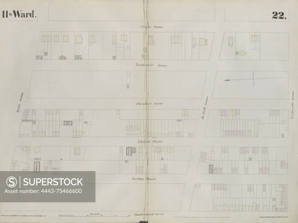
Plate 22 Map bounded by Myrtle Avenue, Clinton Street, Lafayette Avenue, and Cumberland Street, 1855., 1855., New York City, NY. Publisher, William Perris, Brooklyn (New York, N.Y.), Insurance, Fire, Maps
SuperStock offers millions of photos, videos, and stock assets to creatives around the world. This image of Plate 22 Map bounded by Myrtle Avenue, Clinton Street, Lafayette Avenue, and Cumberland Street, 1855., 1855., New York City, NY. Publisher, William Perris, Brooklyn (New York, N.Y.), Insurance, Fire, Maps by Artokoloro is available for licensing today.
Looking for a license?
Click here, and we'll help you find it! Questions? Just ask!
Click here, and we'll help you find it! Questions? Just ask!
DETAILS
Image Number: 4443-75466600Rights ManagedCredit Line:Artokoloro/SuperStockCollection:Artokoloro Model Release:NoProperty Release:NoResolution:5903×4415