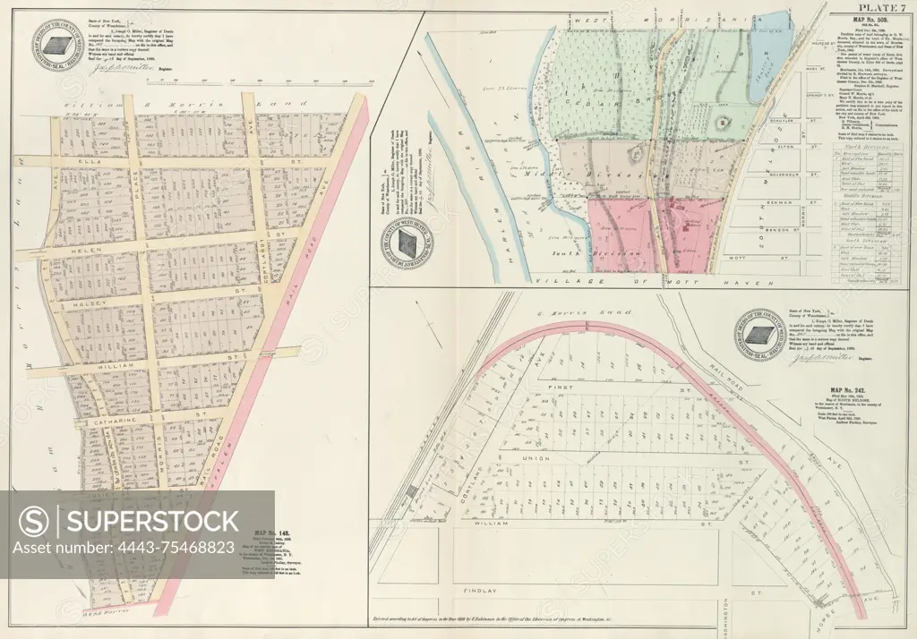
Plate 7 Map No. 148 Bounded by Ella St., Rail Road Ave., Juliet St., and Morrisania Av. - Map No. 509 Bounded by (West Morrisania) Melrose Street, Morris St., Mott St., and Harlem River. - Map No. 242 Bounded by Cortland Ave., First St., Rail Road Ave., and William St., 1888 - 1897, New York, Publisher, E. Robinson Co., Bronx (New York, N.Y.)
SuperStock offers millions of photos, videos, and stock assets to creatives around the world. This image of Plate 7 Map No. 148 Bounded by Ella St., Rail Road Ave., Juliet St., and Morrisania Av. - Map No. 509 Bounded by (West Morrisania) Melrose Street, Morris St., Mott St., and Harlem River. - Map No. 242 Bounded by Cortland Ave., First St., Rail Road Ave., and William St., 1888 - 1897, New York, Publisher, E. Robinson Co., Bronx (New York, N.Y.) by Artokoloro is available for licensing today.
Looking for a license?
Click here, and we'll help you find it! Questions? Just ask!
Click here, and we'll help you find it! Questions? Just ask!
DETAILS
Image Number: 4443-75468823Rights ManagedCredit Line:Artokoloro/SuperStockCollection:Artokoloro Model Release:NoProperty Release:NoResolution:5667×3953