Plate 58 is a map of an area in New York City bounded by West 4th Street, East 4th Street, Green Street, Houston Street, Hancock Street, Bleecker Street, Carmine Street, and Sixth Avenue. The map was issued in 1854 by publisher William Perris and focuses on real property and fire insurance in Manhattan, New York (N.Y.)
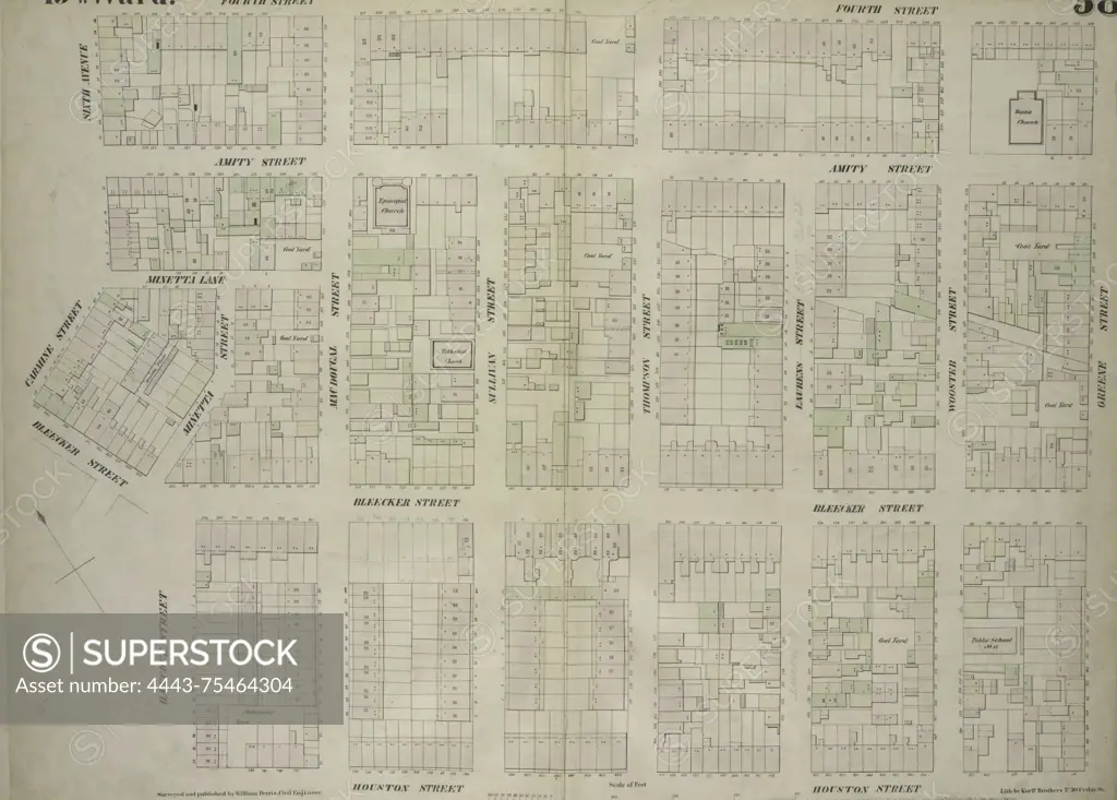
SuperStock offers millions of photos, videos, and stock assets to creatives around the world. This image of Plate 58 is a map of an area in New York City bounded by West 4th Street, East 4th Street, Green Street, Houston Street, Hancock Street, Bleecker Street, Carmine Street, and Sixth Avenue. The map was issued in 1854 by publisher William Perris and focuses on real property and fire insurance in Manhattan, New York (N.Y.) by Artokoloro is available for licensing today.
Looking for a license?
Click here, and we'll help you find it! Questions? Just ask!
Click here, and we'll help you find it! Questions? Just ask!
DETAILS
Image Number: 4443-75464304Rights ManagedCredit Line:Artokoloro/SuperStockCollection:Artokoloro Model Release:NoProperty Release:NoResolution:6297×4513