Plate 15 features three maps Map No. 554, bounded by 138th St., 136th St., and Home Ave.; Map No. 495 (Old No. 83), bounded by 136th St., Home Ave., Willow Ave., 132nd St., and (Old Channel) Stanns Ave.; and Map No. 23, bounded by Turnpike Road to Westchester, The Sound, Bronx Kills, and Mill Brook. The maps were issued between 1888 and 1897 by E. Robinson Co. in Bronx, New York
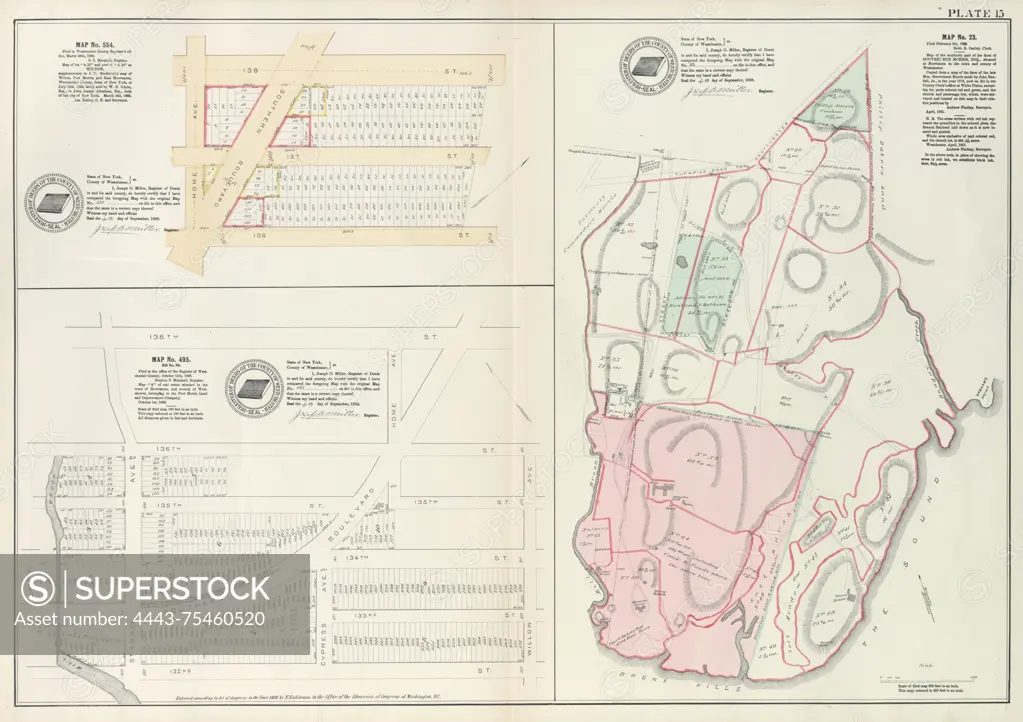
SuperStock offers millions of photos, videos, and stock assets to creatives around the world. This image of Plate 15 features three maps Map No. 554, bounded by 138th St., 136th St., and Home Ave.; Map No. 495 (Old No. 83), bounded by 136th St., Home Ave., Willow Ave., 132nd St., and (Old Channel) Stanns Ave.; and Map No. 23, bounded by Turnpike Road to Westchester, The Sound, Bronx Kills, and Mill Brook. The maps were issued between 1888 and 1897 by E. Robinson Co. in Bronx, New York by Artokoloro is available for licensing today.
Looking for a license?
Click here, and we'll help you find it! Questions? Just ask!
Click here, and we'll help you find it! Questions? Just ask!
DETAILS
Image Number: 4443-75460520Rights ManagedCredit Line:Artokoloro/SuperStockCollection:Artokoloro Model Release:NoProperty Release:NoResolution:5708×4025