Plate 10 features three maps from the E. Robinson Co. issued between 1888 and 1897. Map No. 541 is bounded by Wall St., Grove Ave. (Woodstock), Cliff St., Carr Ave., and Boston Road. Map No. 195 is delineated by the Village of Fairmount, Grove St., Oak St., and Prospect Ave. Map No. 373 is bordered by Wall St., Union Ave., New St., and Forest Ave. The location of these maps is Bronx, New York
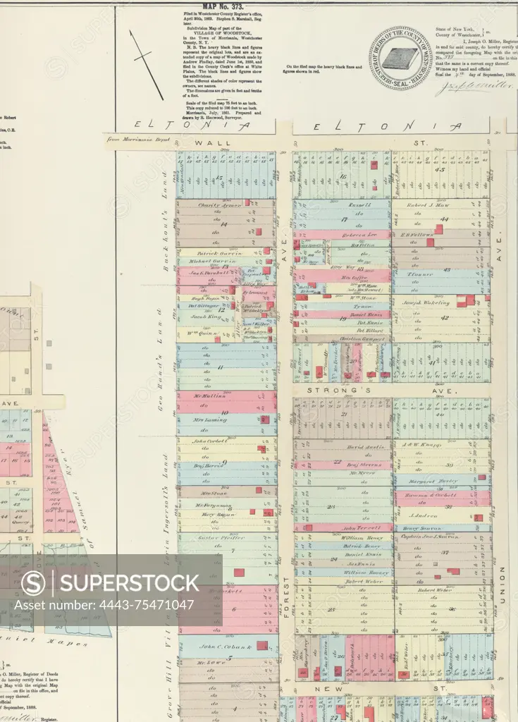
SuperStock offers millions of photos, videos, and stock assets to creatives around the world. This image of Plate 10 features three maps from the E. Robinson Co. issued between 1888 and 1897. Map No. 541 is bounded by Wall St., Grove Ave. (Woodstock), Cliff St., Carr Ave., and Boston Road. Map No. 195 is delineated by the Village of Fairmount, Grove St., Oak St., and Prospect Ave. Map No. 373 is bordered by Wall St., Union Ave., New St., and Forest Ave. The location of these maps is Bronx, New York by Artokoloro is available for licensing today.
Looking for a license?
Click here, and we'll help you find it! Questions? Just ask!
Click here, and we'll help you find it! Questions? Just ask!
DETAILS
Image Number: 4443-75471047Rights ManagedCredit Line:Artokoloro/SuperStockCollection:Artokoloro Model Release:NoProperty Release:NoResolution:2662×3706