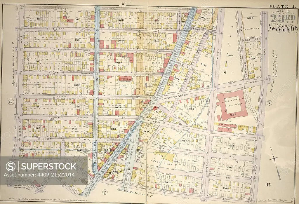
Plate 5: Bounded by E. 154th St., Brook Ave., Westchester Ave., St. Anns Ave., E. 145th St., N. Third Ave., E. 145th St., College Ave.,E. 144th St. and Morris Ave.
SuperStock offers millions of photos, videos, and stock assets to creatives around the world. This image of Explore Historical Cartography: Vintage New York City Map from 1916 - Discover the Architectural and Urban Layout of Early 20th Century Manhattan. by quintlox/Album Archivo/Album is available for licensing today.
Looking for a license?
Click here, and we'll help you find it! Questions? Just ask!
Click here, and we'll help you find it! Questions? Just ask!
DETAILS
Image Number: 4409-21522014Rights ManagedCredit Line:quintlox/Album Archivo/Album/SuperStockCollection:Album Archivo Story:Historical City MapsContributor:quintlox Model Release:NoProperty Release:NoResolution:6400×4368