Plan of the western seat of war, 1865, by H. P. Lathrop. Issued in New Orleans, this map illustrates the American Civil War (1861-1865), specifically focusing on the Confederate States of America and the Southern States. The map measures 35 x 56 cm
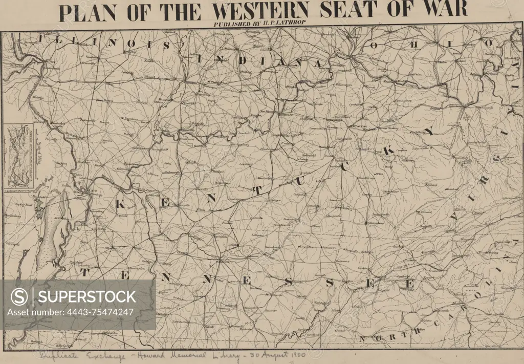
SuperStock offers millions of photos, videos, and stock assets to creatives around the world. This image of Plan of the western seat of war, 1865, by H. P. Lathrop. Issued in New Orleans, this map illustrates the American Civil War (1861-1865), specifically focusing on the Confederate States of America and the Southern States. The map measures 35 x 56 cm by Artokoloro is available for licensing today.
Looking for a license?
Click here, and we'll help you find it! Questions? Just ask!
Click here, and we'll help you find it! Questions? Just ask!
DETAILS
Image Number: 4443-75474247Rights ManagedCredit Line:Artokoloro/SuperStockCollection:Artokoloro Model Release:NoProperty Release:NoResolution:5700×3962