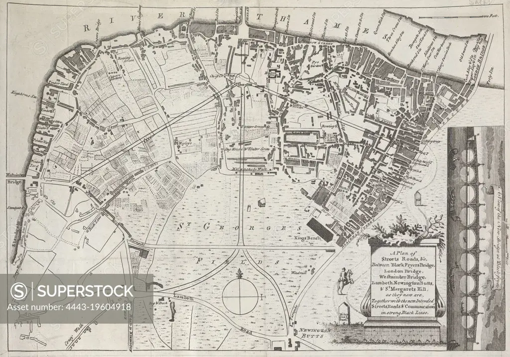
A Plan of Streets, Roads, and Churches, between Black Fryers Bridge, London Bridge, Westminster Bridge, Lambeth, Newington Butts, and St. Margarets Hill...., unknown artist, after unknown artist, 1769, Engraving
SuperStock offers millions of photos, videos, and stock assets to creatives around the world. This image of A Plan of Streets, Roads, and Churches, between Black Fryers Bridge, London Bridge, Westminster Bridge, Lambeth, Newington Butts, and St. Margarets Hill...., unknown artist, after unknown artist, 1769, Engraving by Artokoloro is available for licensing today.
Looking for a license?
Click here, and we'll help you find it! Questions? Just ask!
Click here, and we'll help you find it! Questions? Just ask!
DETAILS
Image Number: 4443-19604918Rights ManagedCredit Line:Artokoloro/SuperStockCollection:Artokoloro Model Release:NoProperty Release:NoResolution:4992×3497