Plan of Lovejoy's narrows from a survey of the Kennebeck River, dated 1826. The map measures 55 x 50 cm, mounted on a sheet of 60 x 53 cm. It is attributed to Washington, D.C., and the publisher is not identified. The map pertains to the Kennebec River and the Kennebec River Valley in Maine
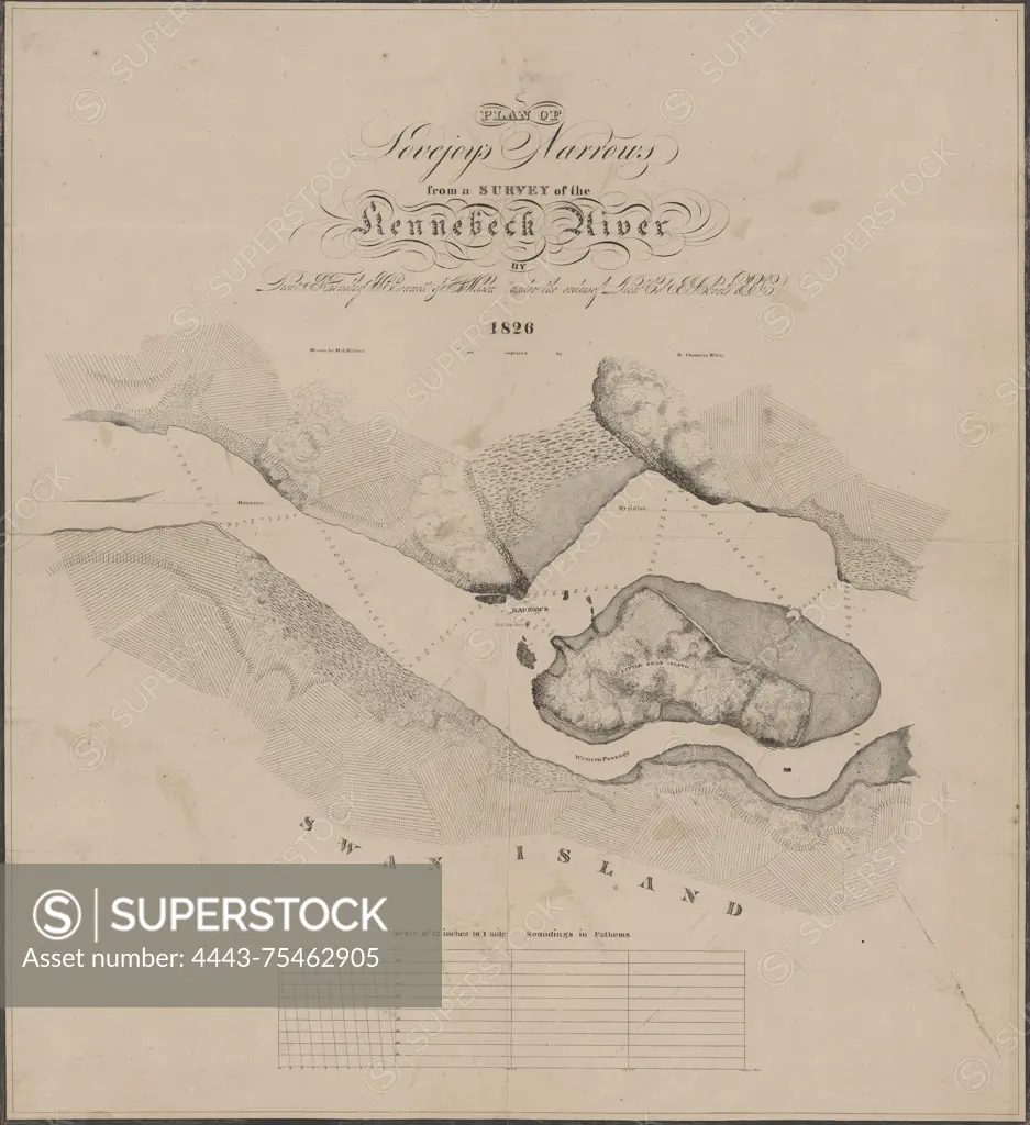
SuperStock offers millions of photos, videos, and stock assets to creatives around the world. This image of Plan of Lovejoy's narrows from a survey of the Kennebeck River, dated 1826. The map measures 55 x 50 cm, mounted on a sheet of 60 x 53 cm. It is attributed to Washington, D.C., and the publisher is not identified. The map pertains to the Kennebec River and the Kennebec River Valley in Maine by Artokoloro is available for licensing today.
Looking for a license?
Click here, and we'll help you find it! Questions? Just ask!
Click here, and we'll help you find it! Questions? Just ask!
DETAILS
Image Number: 4443-75462905Rights ManagedCredit Line:Artokoloro/SuperStockCollection:Artokoloro Model Release:NoProperty Release:NoResolution:5220×5700