Plan of house lots in South Framingham belonging to Lothrop Wight, dated 1830 - 1850. The map measures 55 x 69 cm and is presented on a sheet that is 59 x 73 cm. The place of publication is Cambridge, Mass., and the publisher is not identified. The map includes details related to real property in Framingham, Massachusetts
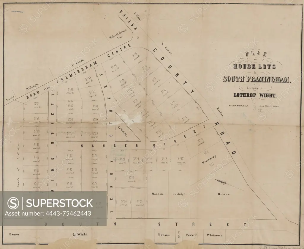
SuperStock offers millions of photos, videos, and stock assets to creatives around the world. This image of Plan of house lots in South Framingham belonging to Lothrop Wight, dated 1830 - 1850. The map measures 55 x 69 cm and is presented on a sheet that is 59 x 73 cm. The place of publication is Cambridge, Mass., and the publisher is not identified. The map includes details related to real property in Framingham, Massachusetts by Artokoloro is available for licensing today.
Looking for a license?
Click here, and we'll help you find it! Questions? Just ask!
Click here, and we'll help you find it! Questions? Just ask!
DETAILS
Image Number: 4443-75462443Rights ManagedCredit Line:Artokoloro/SuperStockCollection:Artokoloro Model Release:NoProperty Release:NoResolution:5700×4662