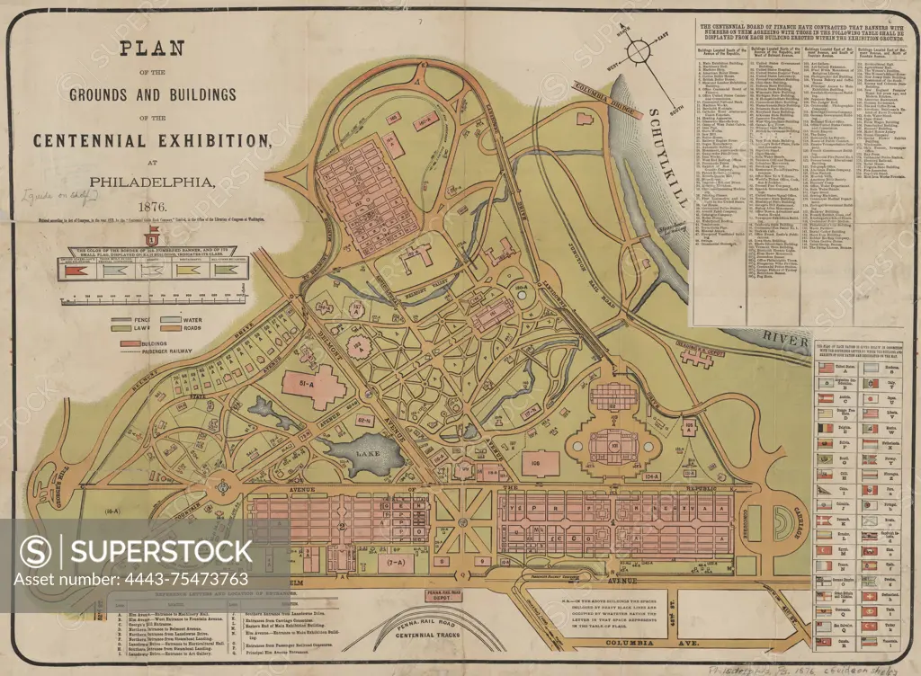
Plan of the grounds and buildings of the Centennial Exhibition at Philadelphia in 1876. The map is colored and measures 43 x 59 cm. It includes numbered buildings, with a total of up to 180 structures detailed, set in Fairmount Park, Philadelphia, Pennsylvania. The map is published by J.B. Lippincott & Co. and is mounted on cloth, with text on the verso that is barely legible
SuperStock offers millions of photos, videos, and stock assets to creatives around the world. This image of Plan of the grounds and buildings of the Centennial Exhibition at Philadelphia in 1876. The map is colored and measures 43 x 59 cm. It includes numbered buildings, with a total of up to 180 structures detailed, set in Fairmount Park, Philadelphia, Pennsylvania. The map is published by J.B. Lippincott & Co. and is mounted on cloth, with text on the verso that is barely legible by Artokoloro is available for licensing today.
Looking for a license?
Click here, and we'll help you find it! Questions? Just ask!
Click here, and we'll help you find it! Questions? Just ask!
DETAILS
Image Number: 4443-75473763Rights ManagedCredit Line:Artokoloro/SuperStockCollection:Artokoloro Model Release:NoProperty Release:NoResolution:5700×4191