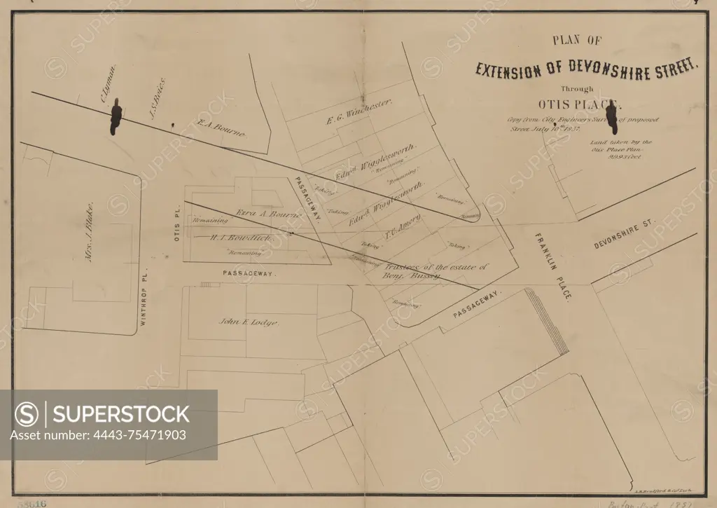
Plan of extension of Devonshire Street through Otis Place, issued in 1857. The map measures 32 x 45 cm on a sheet of 34 x 48 cm. It is associated with real property, landowners, and eminent domain in Boston, Massachusetts. The publisher is not identified
SuperStock offers millions of photos, videos, and stock assets to creatives around the world. This image of Plan of extension of Devonshire Street through Otis Place, issued in 1857. The map measures 32 x 45 cm on a sheet of 34 x 48 cm. It is associated with real property, landowners, and eminent domain in Boston, Massachusetts. The publisher is not identified by Artokoloro is available for licensing today.
Looking for a license?
Click here, and we'll help you find it! Questions? Just ask!
Click here, and we'll help you find it! Questions? Just ask!
DETAILS
Image Number: 4443-75471903Rights ManagedCredit Line:Artokoloro/SuperStockCollection:Artokoloro Model Release:NoProperty Release:NoResolution:5700×4041