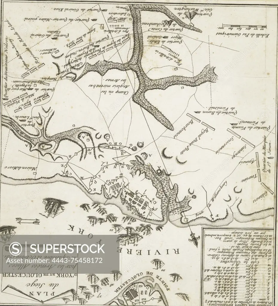
Plan du siège de New York et de Gloucester par les Armées Alliées, en septembre et octobre 1781. Issued in 1781, possibly in Paris. This map, measuring 22 x 20 cm, depicts the siege of Yorktown, Virginia, during the American Revolution (1775-1783), along with relevant campaigns. It is classified as an early work to 1800
SuperStock offers millions of photos, videos, and stock assets to creatives around the world. This image of Plan du siège de New York et de Gloucester par les Armées Alliées, en septembre et octobre 1781. Issued in 1781, possibly in Paris. This map, measuring 22 x 20 cm, depicts the siege of Yorktown, Virginia, during the American Revolution (1775-1783), along with relevant campaigns. It is classified as an early work to 1800 by Artokoloro is available for licensing today.
Looking for a license?
Click here, and we'll help you find it! Questions? Just ask!
Click here, and we'll help you find it! Questions? Just ask!
DETAILS
Image Number: 4443-75458172Rights ManagedCredit Line:Artokoloro/SuperStockCollection:Artokoloro Model Release:NoProperty Release:NoResolution:2327×2558