Plan for the drainage of a section of Brooklyn that directs water into Gowanus Creek and Bay, issued in 1848. The map is published by City Corporation and includes details relevant to Brooklyn, New York, such as drainage systems and canals. It consists of 1 map spread over 2 sheets, measuring 96 x 68 cm in total, with individual sheets measuring 61 x 71 cm and 40 x 71 cm
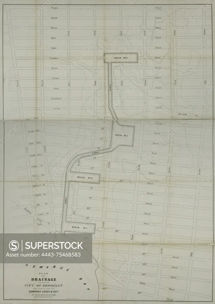
SuperStock offers millions of photos, videos, and stock assets to creatives around the world. This image of Plan for the drainage of a section of Brooklyn that directs water into Gowanus Creek and Bay, issued in 1848. The map is published by City Corporation and includes details relevant to Brooklyn, New York, such as drainage systems and canals. It consists of 1 map spread over 2 sheets, measuring 96 x 68 cm in total, with individual sheets measuring 61 x 71 cm and 40 x 71 cm by Artokoloro is available for licensing today.
Looking for a license?
Click here, and we'll help you find it! Questions? Just ask!
Click here, and we'll help you find it! Questions? Just ask!
DETAILS
Image Number: 4443-75468583Rights ManagedCredit Line:Artokoloro/SuperStockCollection:Artokoloro Model Release:NoProperty Release:NoResolution:4406×6222