Plan des forts, batteries et poste de West Point, 1780, published in 1816 by P. Didot in Paris. The map measures 16 x 11 cm and details the fortifications at West Point, New York, during the American Revolution (1775-1783). It includes depictions of buildings and structures within the area
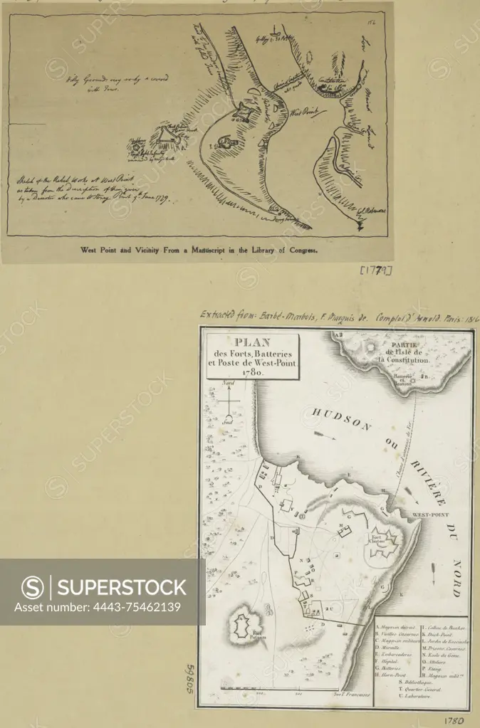
SuperStock offers millions of photos, videos, and stock assets to creatives around the world. This image of Plan des forts, batteries et poste de West Point, 1780, published in 1816 by P. Didot in Paris. The map measures 16 x 11 cm and details the fortifications at West Point, New York, during the American Revolution (1775-1783). It includes depictions of buildings and structures within the area by Artokoloro is available for licensing today.
Looking for a license?
Click here, and we'll help you find it! Questions? Just ask!
Click here, and we'll help you find it! Questions? Just ask!
DETAILS
Image Number: 4443-75462139Rights ManagedCredit Line:Artokoloro/SuperStockCollection:Artokoloro Model Release:NoProperty Release:NoResolution:2372×3601