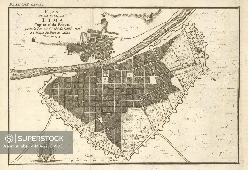
Plan de la ville de Lima, Relation du voyage de la mer du Sud aux cotes du Chili, du Perou, et du Bresil, fait pendant les années 1712, 1713 and 1714, Frézier, Amédée François, 1682-1773, Engraving, etching, black-and-white, 1717
SuperStock offers millions of photos, videos, and stock assets to creatives around the world. This image of Plan de la ville de Lima, Relation du voyage de la mer du Sud aux cotes du Chili, du Perou, et du Bresil, fait pendant les années 1712, 1713 and 1714, Frézier, Amédée François, 1682-1773, Engraving, etching, black-and-white, 1717 by Artokoloro is available for licensing today.
Looking for a license?
Click here, and we'll help you find it! Questions? Just ask!
Click here, and we'll help you find it! Questions? Just ask!
DETAILS
Image Number: 4443-22036995Rights ManagedCredit Line:Artokoloro/SuperStockCollection:Artokoloro Model Release:NoProperty Release:NoResolution:6149×4218