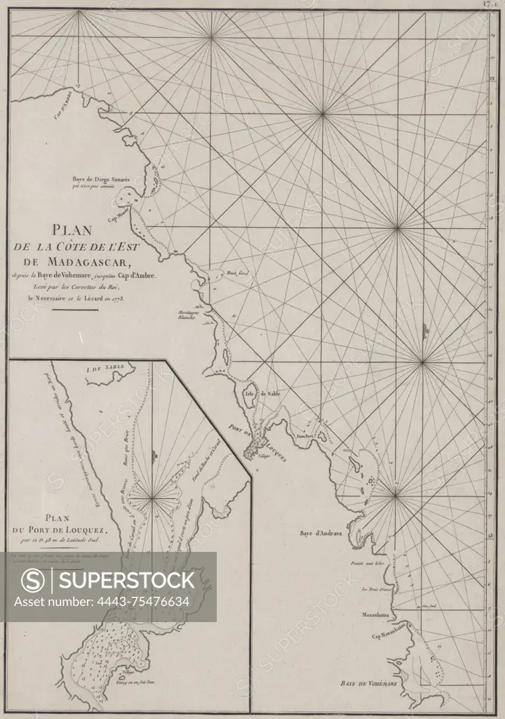
Plan de la côte de l'est de Madagascar, depicting the area from the Baye de Vohemare to the Cap d'Ambre., 1773., S.l. Publisher, s.n. Size 49 x 35 cm. Maps, Early works to 1800. One map included
SuperStock offers millions of photos, videos, and stock assets to creatives around the world. This image of Plan de la côte de l'est de Madagascar, depicting the area from the Baye de Vohemare to the Cap d'Ambre., 1773., S.l. Publisher, s.n. Size 49 x 35 cm. Maps, Early works to 1800. One map included by Artokoloro is available for licensing today.
Looking for a license?
Click here, and we'll help you find it! Questions? Just ask!
Click here, and we'll help you find it! Questions? Just ask!
DETAILS
Image Number: 4443-75476634Rights ManagedCredit Line:Artokoloro/SuperStockCollection:Artokoloro Model Release:NoProperty Release:NoResolution:4139×5886