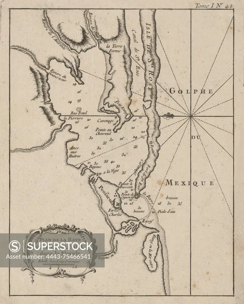
Plan de la Baye de Pensacola dans la Floride, 1764., 1764., Paris. Publisher, publisher not identified. Pensacola Bay (Fla.), Gulf of Mexico., 1 map; 22 x 17 cm on sheet 33 x 26 cm. NYPL Map Division copy pasted on sheet 36 x 31 cm
SuperStock offers millions of photos, videos, and stock assets to creatives around the world. This image of Plan de la Baye de Pensacola dans la Floride, 1764., 1764., Paris. Publisher, publisher not identified. Pensacola Bay (Fla.), Gulf of Mexico., 1 map; 22 x 17 cm on sheet 33 x 26 cm. NYPL Map Division copy pasted on sheet 36 x 31 cm by Artokoloro is available for licensing today.
Looking for a license?
Click here, and we'll help you find it! Questions? Just ask!
Click here, and we'll help you find it! Questions? Just ask!
DETAILS
Image Number: 4443-75466541Rights ManagedCredit Line:Artokoloro/SuperStockCollection:Artokoloro Model Release:NoProperty Release:NoResolution:3567×4436