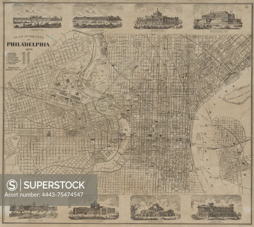
Plan of the city of Philadelphia, 1876. Issued by Mitchell Map Co., this map measures 42 x 53 cm and depicts the layout of Philadelphia, Pennsylvania
SuperStock offers millions of photos, videos, and stock assets to creatives around the world. This image of Plan of the city of Philadelphia, 1876. Issued by Mitchell Map Co., this map measures 42 x 53 cm and depicts the layout of Philadelphia, Pennsylvania by Artokoloro is available for licensing today.
Looking for a license?
Click here, and we'll help you find it! Questions? Just ask!
Click here, and we'll help you find it! Questions? Just ask!
DETAILS
Image Number: 4443-75474547Rights ManagedCredit Line:Artokoloro/SuperStockCollection:Artokoloro Model Release:NoProperty Release:NoResolution:5700×5096