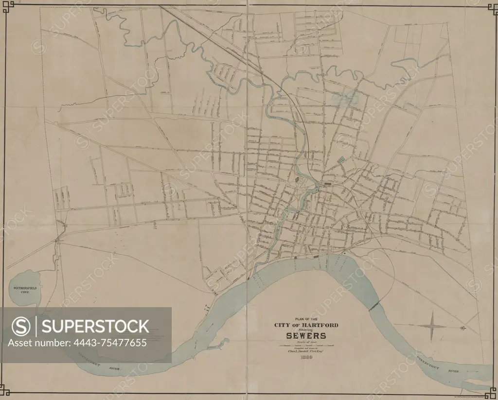
Plan of the city of Hartford showing sewers, 1880. Produced by AM. Photo-Lith. Co. N.Y. (Osborne's Pro.). The map is in color, measuring 68 x 86 cm, printed on a sheet that measures 72 x 89 cm. It outlines sewerage systems in Hartford, Connecticut
SuperStock offers millions of photos, videos, and stock assets to creatives around the world. This image of Plan of the city of Hartford showing sewers, 1880. Produced by AM. Photo-Lith. Co. N.Y. (Osborne's Pro.). The map is in color, measuring 68 x 86 cm, printed on a sheet that measures 72 x 89 cm. It outlines sewerage systems in Hartford, Connecticut by Artokoloro is available for licensing today.
Looking for a license?
Click here, and we'll help you find it! Questions? Just ask!
Click here, and we'll help you find it! Questions? Just ask!
DETAILS
Image Number: 4443-75477655Rights ManagedCredit Line:Artokoloro/SuperStockCollection:Artokoloro Model Release:NoProperty Release:NoResolution:5700×4585