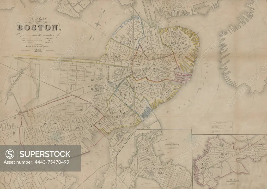
Plan of Boston, prepared under the direction of the Committee on Printing of 1860, issued in 1861. The map, measuring 69 x 95 cm on a sheet of 76 x 105 cm, features hand coloring and illustrates the administrative and political divisions of Boston, including South Boston and East Boston. The publisher is not identified
SuperStock offers millions of photos, videos, and stock assets to creatives around the world. This image of Plan of Boston, prepared under the direction of the Committee on Printing of 1860, issued in 1861. The map, measuring 69 x 95 cm on a sheet of 76 x 105 cm, features hand coloring and illustrates the administrative and political divisions of Boston, including South Boston and East Boston. The publisher is not identified by Artokoloro is available for licensing today.
Looking for a license?
Click here, and we'll help you find it! Questions? Just ask!
Click here, and we'll help you find it! Questions? Just ask!
DETAILS
Image Number: 4443-75470499Rights ManagedCredit Line:Artokoloro/SuperStockCollection:Artokoloro Model Release:NoProperty Release:NoResolution:5700×4033