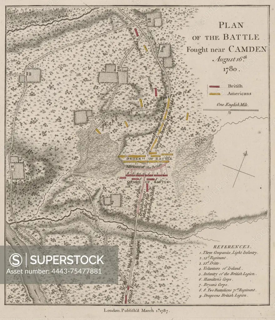
Plan of the battle fought near Camden on August 16, 1780. Issued in 1787 in London by an unidentifiable publisher. The map is hand-colored, measuring 22 x 19 cm, and is pasted on a sheet that measures 39 x 28 cm. The work is associated with Lieutenant-General Banastre Tarleton (1754-1833) and depicts the Battle of Camden during the American Revolution (1775-1783) in Camden, South Carolina
SuperStock offers millions of photos, videos, and stock assets to creatives around the world. This image of Plan of the battle fought near Camden on August 16, 1780. Issued in 1787 in London by an unidentifiable publisher. The map is hand-colored, measuring 22 x 19 cm, and is pasted on a sheet that measures 39 x 28 cm. The work is associated with Lieutenant-General Banastre Tarleton (1754-1833) and depicts the Battle of Camden during the American Revolution (1775-1783) in Camden, South Carolina by Artokoloro is available for licensing today.
Looking for a license?
Click here, and we'll help you find it! Questions? Just ask!
Click here, and we'll help you find it! Questions? Just ask!
DETAILS
Image Number: 4443-75477881Rights ManagedCredit Line:Artokoloro/SuperStockCollection:Artokoloro Model Release:NoProperty Release:NoResolution:4959×5764