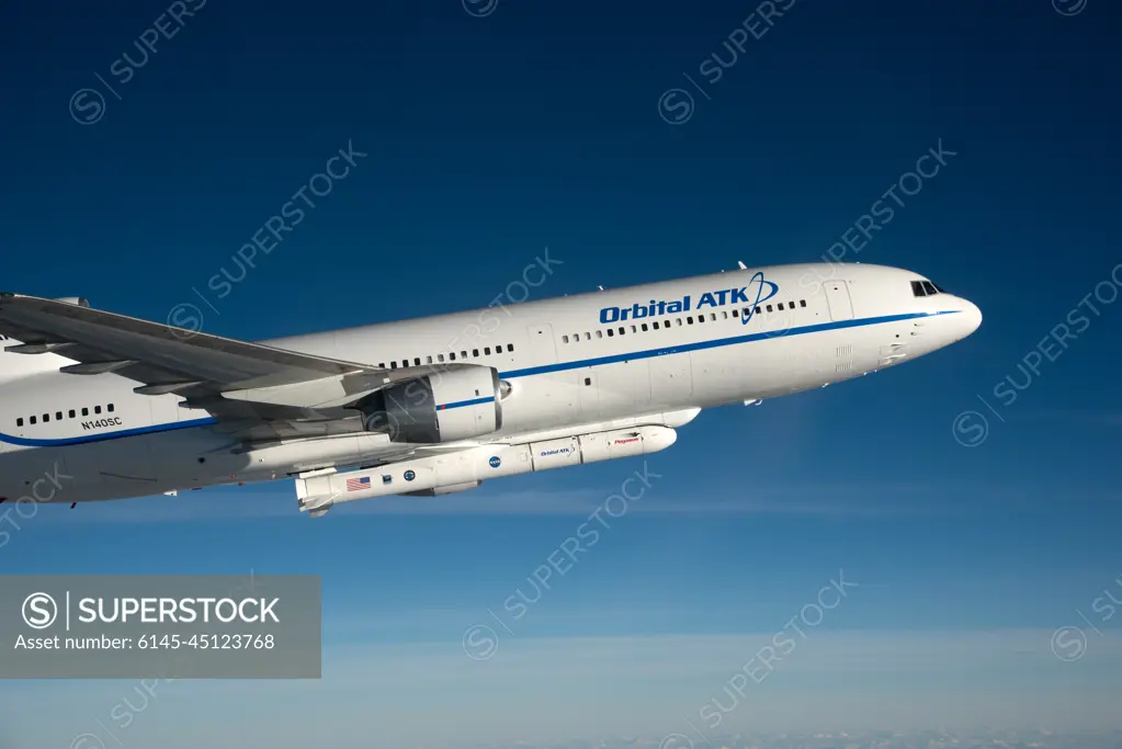
Photographed from the F-18 pathfinder aircraft, the Orbital ATK L-1011 Stargazer aircraft is seen flying over the Atlantic Ocean offshore from Daytona Beach, Florida. Attached beneath the aircraft is the Pegasus XL rocket with eight Cyclone Global Navigation Satellite System, or CYGNSS, spacecraft. The CYGNSS satellites will make frequent and accurate measurements of ocean surface winds throughout the life cycle of tropical storms and hurricanes. The data that CYGNSS provides will enable scientists to probe key air-sea interaction processes that take place near the core of storms, which are rapidly changing and play a crucial role in the beginning and intensification of hurricanes.
SuperStock offers millions of photos, videos, and stock assets to creatives around the world. This image of Photographed from the F-18 pathfinder aircraft, the Orbital ATK L-1011 Stargazer aircraft is seen flying over the Atlantic Ocean offshore from Daytona Beach, Florida. Attached beneath the aircraft is the Pegasus XL rocket with eight Cyclone Global Navigation Satellite System, or CYGNSS, spacecraft. The CYGNSS satellites will make frequent and accurate measurements of ocean surface winds throughout the life cycle of tropical storms and hurricanes. The data that CYGNSS provides will enable scientists to probe key air-sea interaction processes that take place near the core of storms, which are rapidly changing and play a crucial role in the beginning and intensification of hurricanes. by Piemags/PL Photography Limited is available for licensing today.
Looking for a license?
Click here, and we'll help you find it! Questions? Just ask!
Click here, and we'll help you find it! Questions? Just ask!
DETAILS
Image Number: 6145-45123768Royalty FreeCredit Line:Piemags/PL Photography Limited/SuperStockCollection:PL Photography Limited Contributor:Piemags Model Release:NoProperty Release:NoResolution:7360×4912