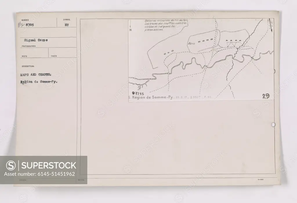
This photograph shows maps and charts related to the region of Somme-Py during World War One. The maps highlight the location of various batteries and indicate the visible signs of explosions. The caption also includes the photograph's identification number (111-SC-8785) and additional details about the specific location and date the photo was taken (Region de Somme-Py on 25.2.17 at an altitude of 2,000m).
SuperStock offers millions of photos, videos, and stock assets to creatives around the world. This image of This photograph shows maps and charts related to the region of Somme-Py during World War One. The maps highlight the location of various batteries and indicate the visible signs of explosions. The caption also includes the photograph's identification number (111-SC-8785) and additional details about the specific location and date the photo was taken (Region de Somme-Py on 25.2.17 at an altitude of 2,000m). by PL Photography Limited is available for licensing today.
Looking for a license?
Click here, and we'll help you find it! Questions? Just ask!
Click here, and we'll help you find it! Questions? Just ask!
DETAILS
Image Number: 6145-51451962Royalty FreeCredit Line:PL Photography Limited/SuperStockCollection:PL Photography Limited Model Release:NoProperty Release:NoResolution:9177×6297