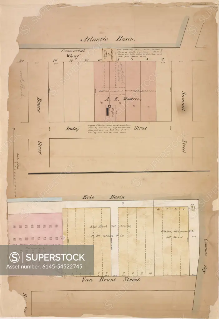
Perris, William. Cartographic, Maps. 1861. Lionel Pincus and Princess Firyal Map Division. Brooklyn (New York, N.Y.), Warehouses , New York (State) , New York, Insurance , New York (State) , New York Page Plate No. 11; Map bounded by Atlantic Basin, Summit St., Gowanus Bay, Van Brunt St.; Including Erie Basin, Bowne St., Imlay St.
SuperStock offers millions of photos, videos, and stock assets to creatives around the world. This image of Perris, William. Cartographic, Maps. 1861. Lionel Pincus and Princess Firyal Map Division. Brooklyn (New York, N.Y.), Warehouses , New York (State) , New York, Insurance , New York (State) , New York Page Plate No. 11; Map bounded by Atlantic Basin, Summit St., Gowanus Bay, Van Brunt St.; Including Erie Basin, Bowne St., Imlay St. by piemags/PL Photography Limited is available for licensing today.
Looking for a license?
Click here, and we'll help you find it! Questions? Just ask!
Click here, and we'll help you find it! Questions? Just ask!
DETAILS
Image Number: 6145-54522745Royalty FreeCredit Line:piemags/PL Photography Limited/SuperStockCollection:PL Photography Limited Contributor:piemags Model Release:NoProperty Release:NoResolution:3691×5382