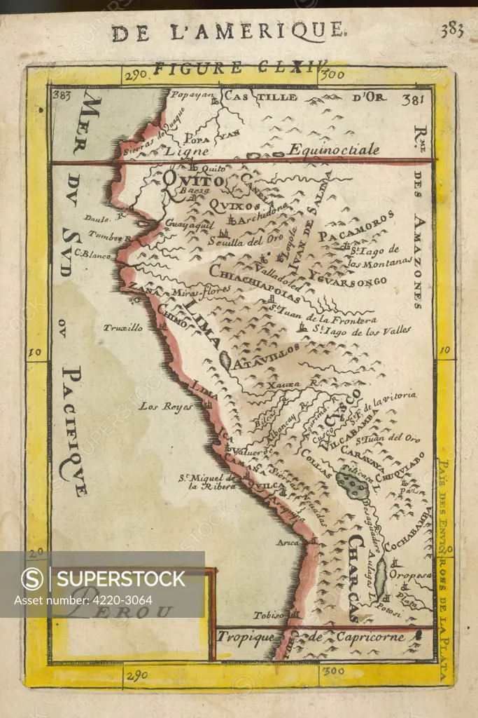
Perou. A map showing a coastalpart of South America on theSouth Pacific. Both theequator and tropic ofCapricorn are given.Date: 1683
SuperStock offers millions of photos, videos, and stock assets to creatives around the world. This image of Explore Historical Peru Through an Antique Map: A Glimpse into South America's Rich Past by Mary Evans Picture Library/Pantheon is available for licensing today.
Looking for a license?
Click here, and we'll help you find it! Questions? Just ask!
Click here, and we'll help you find it! Questions? Just ask!
DETAILS
Image Number: 4220-3064Rights ManagedCredit Line:Mary Evans Picture Library/Pantheon/SuperStockCollection:Mary Evans Picture Library Model Release:NoProperty Release:NoResolution:2964×4441