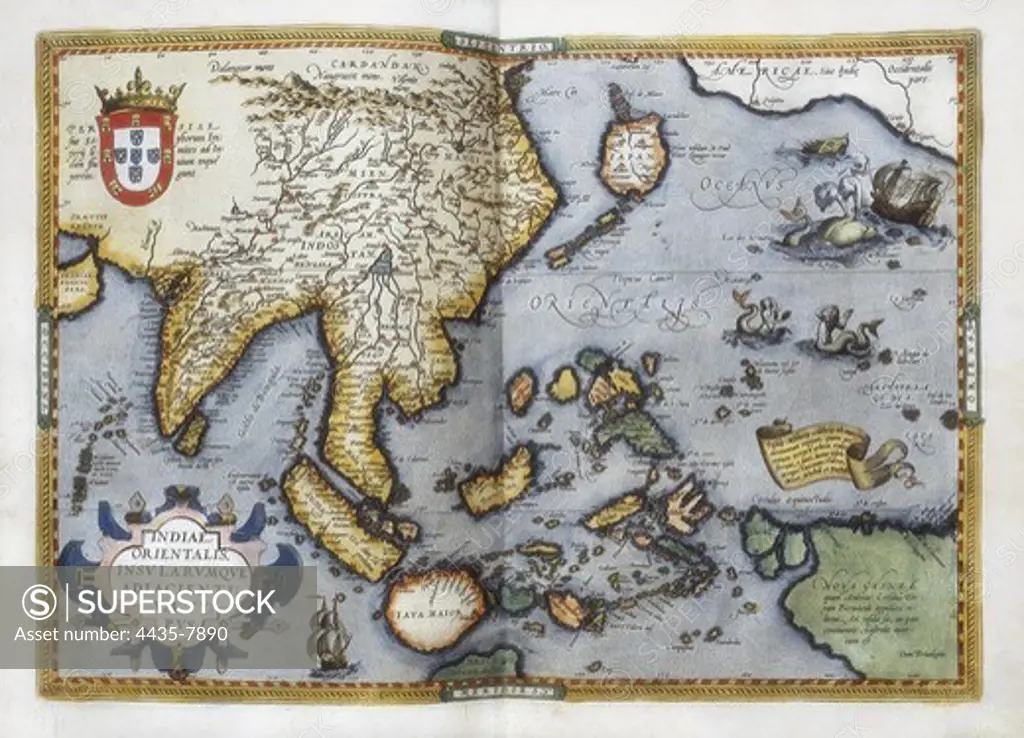
ORTELIUS, Abraham (1527-1598). Theatrum Orbis Terrarum. 1570. It is considered to be the first modern atlas. Map of the Pacific Ocean depicting China, Japan, Alaska, India and Southeast Asia. Printed in Antwerp by Christophe Plantin (1588). Etching. SPAIN. CASTILE AND LEON. Salamanca. Salamanca University Library.
SuperStock offers millions of photos, videos, and stock assets to creatives around the world. This image of ORTELIUS, Abraham (1527-1598). Theatrum Orbis Terrarum. 1570. It is considered to be the first modern atlas. Map of the Pacific Ocean depicting China, Japan, Alaska, India and Southeast Asia. Printed in Antwerp by Christophe Plantin (1588). Etching. SPAIN. CASTILE AND LEON. Salamanca. Salamanca University Library. by Iberfoto Archivo/Iberfoto is available for licensing today.
Looking for a license?
Click here, and we'll help you find it! Questions? Just ask!
Click here, and we'll help you find it! Questions? Just ask!
DETAILS
Image Number: 4435-7890Rights ManagedCredit Line:Iberfoto Archivo/Iberfoto/SuperStockCollection:Iberfoto Archivo Model Release:NoProperty Release:NoResolution:5060×3659