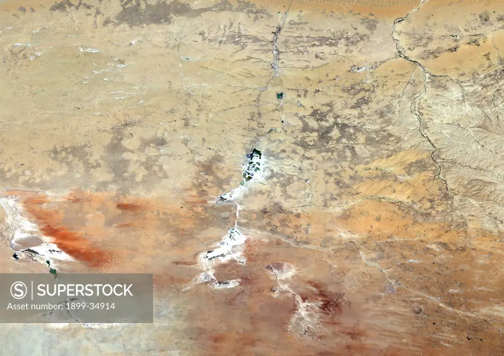
Ordos Plateau, China, True Colour Satellite Image. Ordos Plateau, China, true colour satellite image. The Ordos plateau in Inner Mongolia in the Gobi desert ; rust coloured areas correspond to oxidised rock formations scattered by the Western winds ; on the left of the picture, a dry river has left behing a small emerald lake. Image taken on 1 July 1994 using LANDSAT data.
SuperStock offers millions of photos, videos, and stock assets to creatives around the world. This image of Ordos Plateau, China, True Colour Satellite Image. Ordos Plateau, China, true colour satellite image. The Ordos plateau in Inner Mongolia in the Gobi desert ; rust coloured areas correspond to oxidised rock formations scattered by the Western winds ; on the left of the picture, a dry river has left behing a small emerald lake. Image taken on 1 July 1994 using LANDSAT data. by Universal Images is available for licensing today.
Looking for a license?
Click here, and we'll help you find it! Questions? Just ask!
Click here, and we'll help you find it! Questions? Just ask!
DETAILS
Image Number: 1899-34914Rights ManagedCredit Line:Universal Images/SuperStockCollection:Universal Images Model Release:NoProperty Release:NoResolution:4961×3508