The official railway map of Ohio, published in 1884 by R. Sutton. The map is hand-colored and measures 52 x 55 cm. It provides an overview of the railroad system in Ohio and was issued in Wapakoneta, Ohio
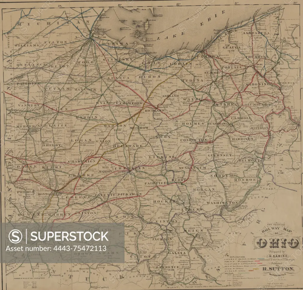
SuperStock offers millions of photos, videos, and stock assets to creatives around the world. This image of The official railway map of Ohio, published in 1884 by R. Sutton. The map is hand-colored and measures 52 x 55 cm. It provides an overview of the railroad system in Ohio and was issued in Wapakoneta, Ohio by Artokoloro is available for licensing today.
Looking for a license?
Click here, and we'll help you find it! Questions? Just ask!
Click here, and we'll help you find it! Questions? Just ask!
DETAILS
Image Number: 4443-75472113Rights ManagedCredit Line:Artokoloro/SuperStockCollection:Artokoloro Model Release:NoProperty Release:NoResolution:5700×5463