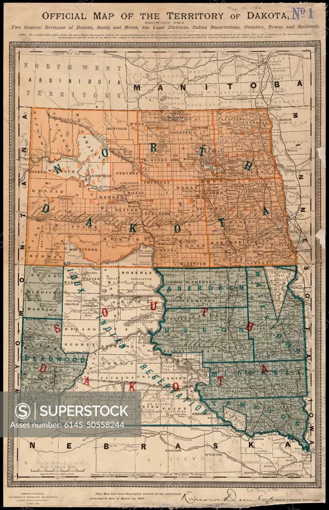
Official map of the territory of Dakota, showing the two general divisions of Dakota, South and North, the land districts, Indian reservations, counties, towns and railroads , Indians of North America, Dakota Territory, Maps, Indian reservations, Dakota Territory, Maps, Dakota Territory, Maps, North Dakota, Maps, South Dakota, Maps Norman B. Leventhal Map Center Collection
SuperStock offers millions of photos, videos, and stock assets to creatives around the world. This image of Official map of the territory of Dakota, showing the two general divisions of Dakota, South and North, the land districts, Indian reservations, counties, towns and railroads , Indians of North America, Dakota Territory, Maps, Indian reservations, Dakota Territory, Maps, Dakota Territory, Maps, North Dakota, Maps, South Dakota, Maps Norman B. Leventhal Map Center Collection by Piemags/PL Photography Limited is available for licensing today.
DETAILS
Image Number: 6145-50558244Royalty FreeCredit Line:Piemags/PL Photography Limited/SuperStockCollection:PL Photography Limited Contributor:Piemags Model Release:NoProperty Release:NoResolution:3832×5932
Free Research
Can't find the usage you need?
We're here to help!
Phone:+1 866 236 0087
Email: help@superstock.com
or fill out a Contact Form
Research / License Request Form
Can't find the usage you need?
We're here to help!
Phone:
or fill out a Contact Form
Research / License Request Form
Retouching Services
Our MediaMagnet division offers comprehensive retouching services at great rates. For a free quote, please send us an e-mail and we'll get back to you promptly.
Email: Retouching Service
Our MediaMagnet division offers comprehensive retouching services at great rates. For a free quote, please send us an e-mail and we'll get back to you promptly.
Email: Retouching Service