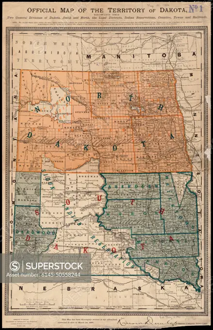
Official map of the territory of Dakota, showing the two general divisions of Dakota, South and North, the land districts, Indian reservations, counties, towns and railroads , Indians of North America, Dakota Territory, Maps, Indian reservations, Dakota Territory, Maps, Dakota Territory, Maps, North Dakota, Maps, South Dakota, Maps Norman B. Leventhal Map Center Collection
SuperStock offers millions of photos, videos, and stock assets to creatives around the world. This image of Official map of the territory of Dakota, showing the two general divisions of Dakota, South and North, the land districts, Indian reservations, counties, towns and railroads , Indians of North America, Dakota Territory, Maps, Indian reservations, Dakota Territory, Maps, Dakota Territory, Maps, North Dakota, Maps, South Dakota, Maps Norman B. Leventhal Map Center Collection by Piemags/PL Photography Limited is available for licensing today.
DETAILS
Image Number: 6145-50558244Royalty FreeCredit Line:Piemags/PL Photography Limited/SuperStockCollection:PL Photography Limited Contributor:Piemags Model Release:NoProperty Release:NoResolution:3832×5932