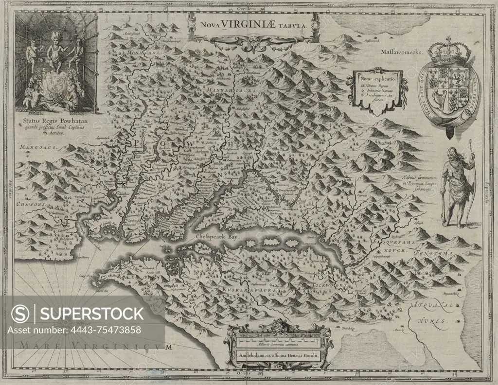
Nova Virginiae tabula, 1637, by Hendrik Hondius. Issued in Amsterdam by Ex officina Henrici Hondii. The map covers the Virginia, Maryland, and Chesapeake Bay Region. Size 36 x 48 cm
SuperStock offers millions of photos, videos, and stock assets to creatives around the world. This image of Nova Virginiae tabula, 1637, by Hendrik Hondius. Issued in Amsterdam by Ex officina Henrici Hondii. The map covers the Virginia, Maryland, and Chesapeake Bay Region. Size 36 x 48 cm by Artokoloro is available for licensing today.
Looking for a license?
Click here, and we'll help you find it! Questions? Just ask!
Click here, and we'll help you find it! Questions? Just ask!
DETAILS
Image Number: 4443-75473858Rights ManagedCredit Line:Artokoloro/SuperStockCollection:Artokoloro Model Release:NoProperty Release:NoResolution:6222×4813