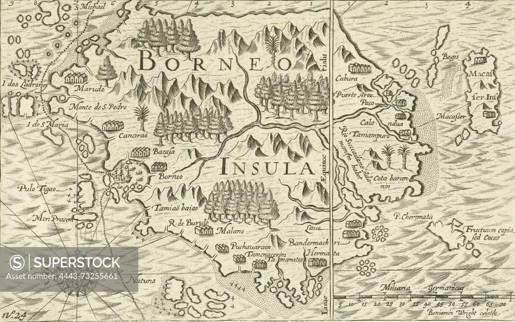
Northern Netherlands, Wright, Benjamin, Borneo Insula, Map of the island of Borneo, 1601, Map of the island of Borneo with the mapped out route of the ship Mauritius, January 1601. On the right the scales and the island of Makassar. Part of the illustrations in the report of the voyage around the world by Olivier van Noort in 1598-1601. No. 24., print, prent, nieuwsprent, map, prints, Frederik Muller Historical Plates, height 145 mm, width 225 mm, English, 1575, print maker, printmaker, 1601 - 1602, first quarter 17th century, second quarter 17th century, paper, engraving, engraving (printing process)
SuperStock offers millions of photos, videos, and stock assets to creatives around the world. This image of Northern Netherlands, Wright, Benjamin, Borneo Insula, Map of the island of Borneo, 1601, Map of the island of Borneo with the mapped out route of the ship Mauritius, January 1601. On the right the scales and the island of Makassar. Part of the illustrations in the report of the voyage around the world by Olivier van Noort in 1598-1601. No. 24., print, prent, nieuwsprent, map, prints, Frederik Muller Historical Plates, height 145 mm, width 225 mm, English, 1575, print maker, printmaker, 1601 - 1602, first quarter 17th century, second quarter 17th century, paper, engraving, engraving (printing process) by Artokoloro is available for licensing today.
Looking for a license?
Click here, and we'll help you find it! Questions? Just ask!
Click here, and we'll help you find it! Questions? Just ask!
DETAILS
Image Number: 4443-73255661Rights ManagedCredit Line:Artokoloro/SuperStockCollection:Artokoloro Model Release:NoProperty Release:NoResolution:5368×3359