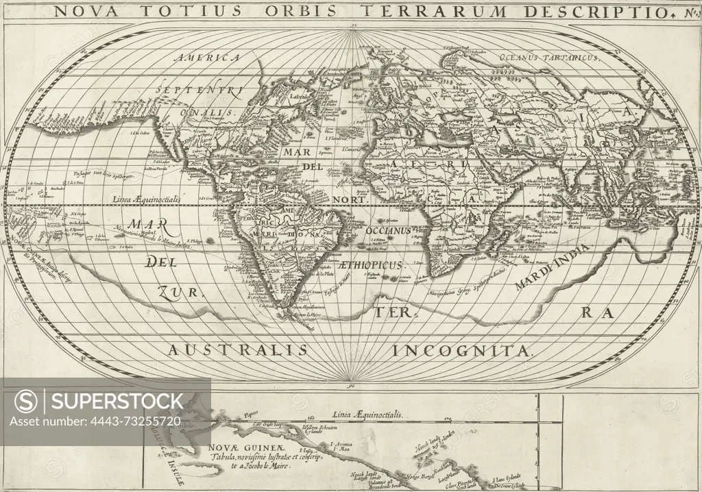
Northern Netherlands, Nova Totius Orbis Terrarum Descriptio, Map of the world with the travels of Joris van Spilbergen and Jacob le Maire around the world, 1614-1617, Map of the world showing the travels of Joris van Spilbergen and Jacob le Maire around the world, 1614-1617. At the bottom a detail of the north coast of New Guinea. Part of the illustrations in the report of the journey of Joris van Spilbergen around the world, No. 1., print, picture, news print, map, prints, pictures, Frederik Muller Historieplaten, height 320 mm, width 448 mm, print maker, printmaker, 1617 - 1619, second quarter 17th century, paper, engraving, engraving (printing process)
SuperStock offers millions of photos, videos, and stock assets to creatives around the world. This image of Northern Netherlands, Nova Totius Orbis Terrarum Descriptio, Map of the world with the travels of Joris van Spilbergen and Jacob le Maire around the world, 1614-1617, Map of the world showing the travels of Joris van Spilbergen and Jacob le Maire around the world, 1614-1617. At the bottom a detail of the north coast of New Guinea. Part of the illustrations in the report of the journey of Joris van Spilbergen around the world, No. 1., print, picture, news print, map, prints, pictures, Frederik Muller Historieplaten, height 320 mm, width 448 mm, print maker, printmaker, 1617 - 1619, second quarter 17th century, paper, engraving, engraving (printing process) by Artokoloro is available for licensing today.
Looking for a license?
Click here, and we'll help you find it! Questions? Just ask!
Click here, and we'll help you find it! Questions? Just ask!
DETAILS
Image Number: 4443-73255720Rights ManagedCredit Line:Artokoloro/SuperStockCollection:Artokoloro Model Release:NoProperty Release:NoResolution:6177×4333