Northern Netherlands, The Great Tableau of Folly, Pasquin's Wind Map on the Wind Trade of the Year 1720, Pasquin's Wind Map on the Wind Trade of 1720, Pasquin's Wind Map on the Wind Trade of 1720. Sheet with a complete deck of 52 playing cards, each card with a representation and verse related to the wind trade. Print in the bound fourth edition (304 B 12) of The Great Tableau of Folly with cartoons on the Wind Trade or Action Trade of 1720., print, cartoon, books, Frederik Muller Historieplaten, height 525 mm, width 450 mm, print maker, printmaker, 1720 - 1720, paper, papier, etching, etsen
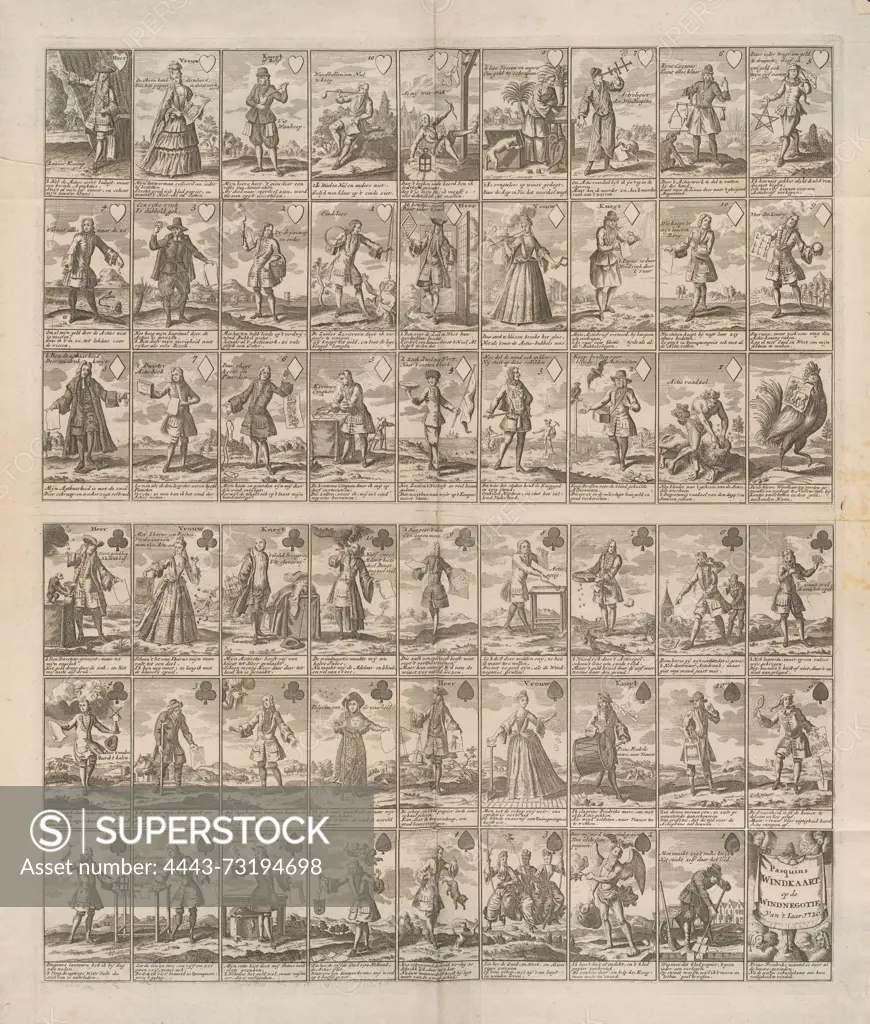
SuperStock offers millions of photos, videos, and stock assets to creatives around the world. This image of Northern Netherlands, The Great Tableau of Folly, Pasquin's Wind Map on the Wind Trade of the Year 1720, Pasquin's Wind Map on the Wind Trade of 1720, Pasquin's Wind Map on the Wind Trade of 1720. Sheet with a complete deck of 52 playing cards, each card with a representation and verse related to the wind trade. Print in the bound fourth edition (304 B 12) of The Great Tableau of Folly with cartoons on the Wind Trade or Action Trade of 1720., print, cartoon, books, Frederik Muller Historieplaten, height 525 mm, width 450 mm, print maker, printmaker, 1720 - 1720, paper, papier, etching, etsen by Artokoloro is available for licensing today.
Looking for a license?
Click here, and we'll help you find it! Questions? Just ask!
Click here, and we'll help you find it! Questions? Just ask!
DETAILS
Image Number: 4443-73194698Rights ManagedCredit Line:Artokoloro/SuperStockCollection:Artokoloro Model Release:NoProperty Release:NoResolution:4593×5400