NOAA's GOES-East satellite provided a visible-light image of Tropical Storm Harvey; August 30, 2017 at 7:30 a.m. EDT, after it made landfall at 4 a.m. CDT just west of Cameron, Louisiana. The widespread and catastrophic effects of Hurricane Harvey resulted in one of the costliest natural disasters in United States history. An estimated 300,000 structures and 500,000 vehicles were damaged or destroyed in Texas alone. The National Oceanic and Atmospheric Administration estimated total damage at $125 billion, with a 90% confidence interval of $90-160 billion. The scope of flooding in areas with low National Flood Insurance Program (NFIP) participation lends to the large uncertainty in the damage total. This ranks Harvey as the costliest tropical cyclone on record in the country alongside Hurricane Katrina in 2005
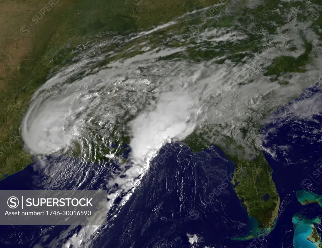
SuperStock offers millions of photos, videos, and stock assets to creatives around the world. This image of NOAA's GOES-East satellite provided a visible-light image of Tropical Storm Harvey; August 30, 2017 at 7:30 a.m. EDT, after it made landfall at 4 a.m. CDT just west of Cameron, Louisiana. The widespread and catastrophic effects of Hurricane Harvey resulted in one of the costliest natural disasters in United States history. An estimated 300,000 structures and 500,000 vehicles were damaged or destroyed in Texas alone. The National Oceanic and Atmospheric Administration estimated total damage at $125 billion, with a 90% confidence interval of $90-160 billion. The scope of flooding in areas with low National Flood Insurance Program (NFIP) participation lends to the large uncertainty in the damage total. This ranks Harvey as the costliest tropical cyclone on record in the country alongside Hurricane Katrina in 2005 by NASA/NOAA GOES Project/World His/Image Asset Management/World History Archive is available for licensing today.
Looking for a license?
Click here, and we'll help you find it! Questions? Just ask!
Click here, and we'll help you find it! Questions? Just ask!
DETAILS
Image Number: 1746-30016590Rights ManagedCredit Line:NASA/NOAA GOES Project/World His/Image Asset Management/World History Archive/SuperStockCollection:Image Asset Management Contributor:NASA/NOAA GOES Project/World His Model Release:NoProperty Release:NoResolution:5213×4023