New York City map by Humphrey Phelps, created in 1857. The map measures 38 x 66 cm on a sheet of 43 x 74 cm. It includes various geographic features and administrative divisions of New York City, as well as maps of Jersey City and Hoboken. It presents details relating to fire protection districts, railroads, ferries, and piers in the area. The publisher is H. Phelps, based in New York
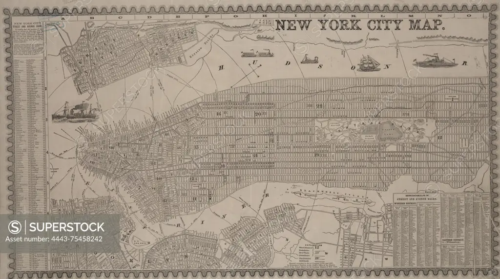
SuperStock offers millions of photos, videos, and stock assets to creatives around the world. This image of New York City map by Humphrey Phelps, created in 1857. The map measures 38 x 66 cm on a sheet of 43 x 74 cm. It includes various geographic features and administrative divisions of New York City, as well as maps of Jersey City and Hoboken. It presents details relating to fire protection districts, railroads, ferries, and piers in the area. The publisher is H. Phelps, based in New York by Artokoloro is available for licensing today.
Looking for a license?
Click here, and we'll help you find it! Questions? Just ask!
Click here, and we'll help you find it! Questions? Just ask!
DETAILS
Image Number: 4443-75458242Rights ManagedCredit Line:Artokoloro/SuperStockCollection:Artokoloro Model Release:NoProperty Release:NoResolution:5700×3184