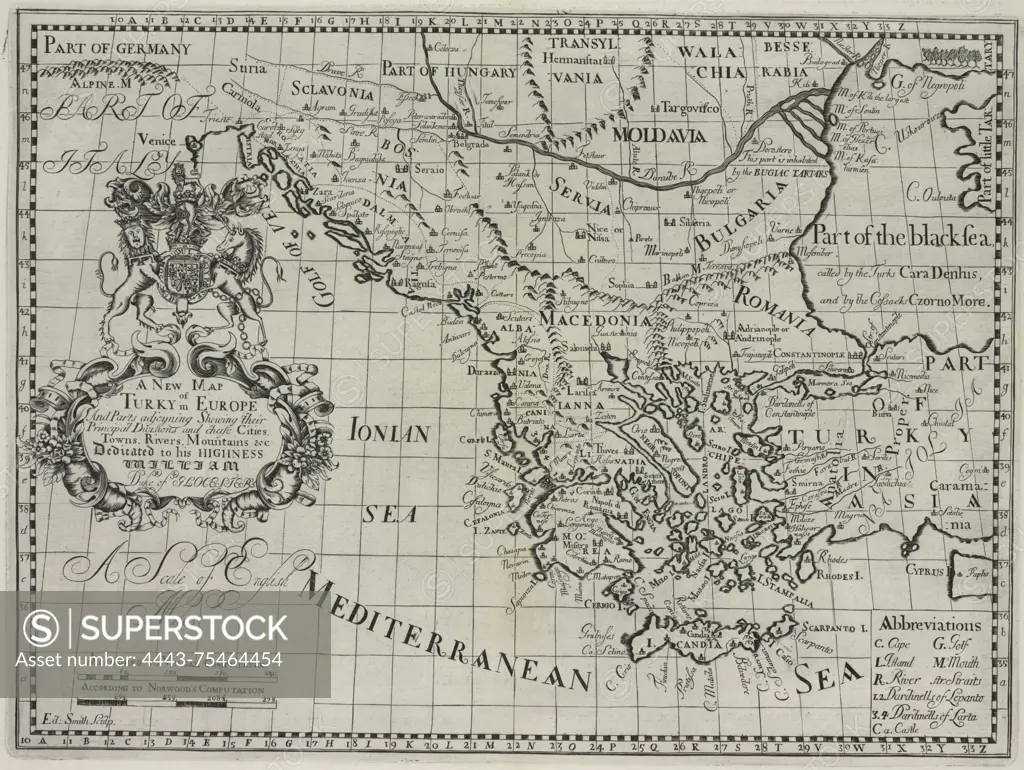
A new map of Turkey in Europe and parts adjoining, showing their principal divisions, chief cities, towns, rivers, and mountains, dated 1700. It includes an additional, 'Turkye in Europe.' Published in Oxford at the Sheldonian Theatre. Relevant subjects include atlases, British geography, ancient maps, and maps in education
SuperStock offers millions of photos, videos, and stock assets to creatives around the world. This image of A new map of Turkey in Europe and parts adjoining, showing their principal divisions, chief cities, towns, rivers, and mountains, dated 1700. It includes an additional, 'Turkye in Europe.' Published in Oxford at the Sheldonian Theatre. Relevant subjects include atlases, British geography, ancient maps, and maps in education by Artokoloro is available for licensing today.
Looking for a license?
Click here, and we'll help you find it! Questions? Just ask!
Click here, and we'll help you find it! Questions? Just ask!
DETAILS
Image Number: 4443-75464454Rights ManagedCredit Line:Artokoloro/SuperStockCollection:Artokoloro Model Release:NoProperty Release:NoResolution:4897×3687