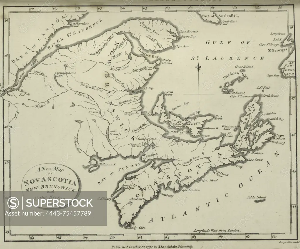
A new map of Nova Scotia, New Brunswick, and Cape Breton, published in 1794 by John Stockdale, London
SuperStock offers millions of photos, videos, and stock assets to creatives around the world. This image of A new map of Nova Scotia, New Brunswick, and Cape Breton, published in 1794 by John Stockdale, London by Artokoloro is available for licensing today.
Looking for a license?
Click here, and we'll help you find it! Questions? Just ask!
Click here, and we'll help you find it! Questions? Just ask!
DETAILS
Image Number: 4443-75457789Rights ManagedCredit Line:Artokoloro/SuperStockCollection:Artokoloro Model Release:NoProperty Release:NoResolution:4916×4078