New map of Missouri, 1868, by G.W. & C.B. Colton & Co. The hand-colored map features railroads, administrative and political divisions, and the Saint Louis Region. The map measures 31 x 37 cm, on a sheet measuring 34 x 41 cm. Published in New York at 172 William St. in 1868
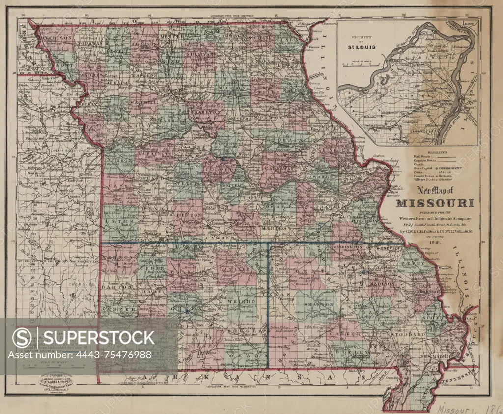
SuperStock offers millions of photos, videos, and stock assets to creatives around the world. This image of New map of Missouri, 1868, by G.W. & C.B. Colton & Co. The hand-colored map features railroads, administrative and political divisions, and the Saint Louis Region. The map measures 31 x 37 cm, on a sheet measuring 34 x 41 cm. Published in New York at 172 William St. in 1868 by Artokoloro is available for licensing today.
Looking for a license?
Click here, and we'll help you find it! Questions? Just ask!
Click here, and we'll help you find it! Questions? Just ask!
DETAILS
Image Number: 4443-75476988Rights ManagedCredit Line:Artokoloro/SuperStockCollection:Artokoloro Model Release:NoProperty Release:NoResolution:5700×4689