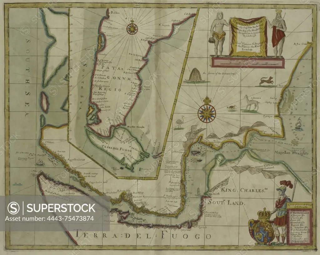
A new map of the Magellan Straits discovered by Captain John Narbourgh, commander of His Majesty's Ship Sweepstakes, as he sailed through said straits., 1702 - 1707, London, Nautical charts, Magellan, Strait of (Chile and Argentina)
SuperStock offers millions of photos, videos, and stock assets to creatives around the world. This image of A new map of the Magellan Straits discovered by Captain John Narbourgh, commander of His Majesty's Ship Sweepstakes, as he sailed through said straits., 1702 - 1707, London, Nautical charts, Magellan, Strait of (Chile and Argentina) by Artokoloro is available for licensing today.
Looking for a license?
Click here, and we'll help you find it! Questions? Just ask!
Click here, and we'll help you find it! Questions? Just ask!
DETAILS
Image Number: 4443-75473874Rights ManagedCredit Line:Artokoloro/SuperStockCollection:Artokoloro Model Release:NoProperty Release:NoResolution:5708×4557