A new map of Denmark, Norway, Sweden, and Moscovy from 1700, displaying their current general divisions, chief cities or towns, rivers, and mountains. The map is associated with the Sheldonian Theatre in Oxford, where it was printed. The additional title is 'Denmark, Norway, Sweden, and Muscovy.' The work is categorized under atlases, British geography, ancient maps, and maps in education
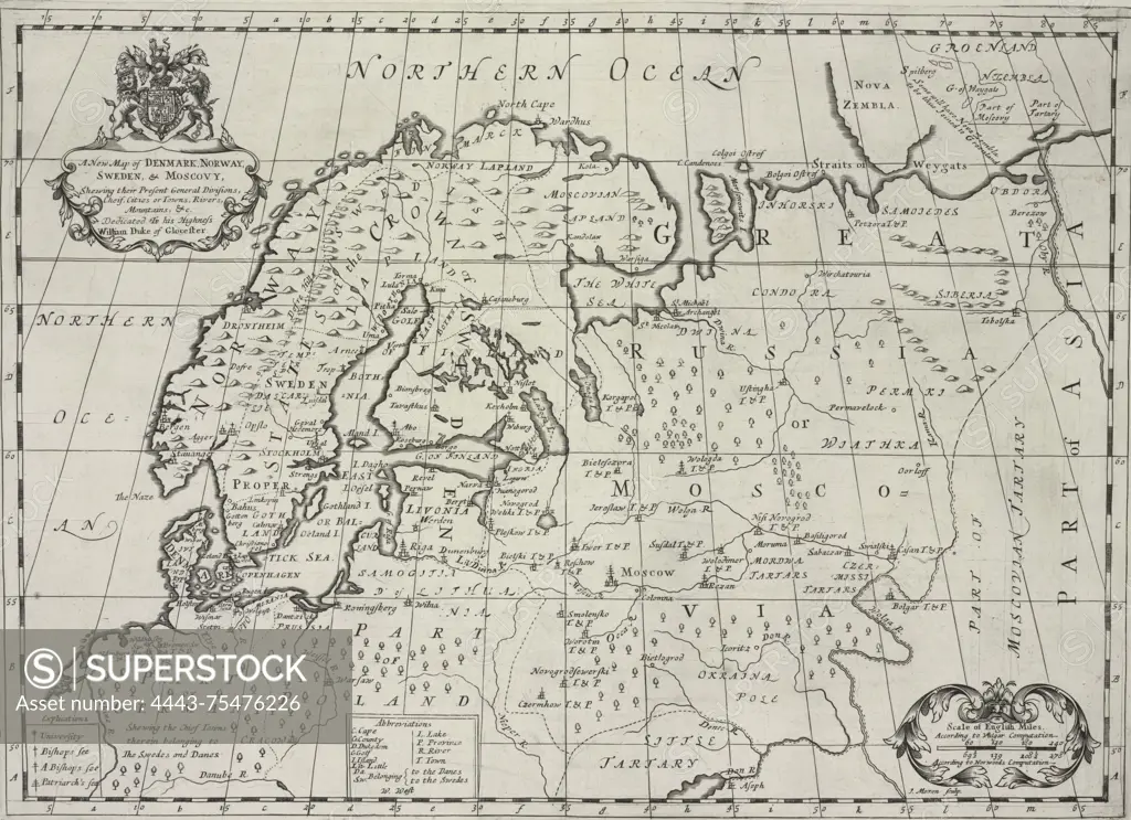
SuperStock offers millions of photos, videos, and stock assets to creatives around the world. This image of A new map of Denmark, Norway, Sweden, and Moscovy from 1700, displaying their current general divisions, chief cities or towns, rivers, and mountains. The map is associated with the Sheldonian Theatre in Oxford, where it was printed. The additional title is 'Denmark, Norway, Sweden, and Muscovy.' The work is categorized under atlases, British geography, ancient maps, and maps in education by Artokoloro is available for licensing today.
Looking for a license?
Click here, and we'll help you find it! Questions? Just ask!
Click here, and we'll help you find it! Questions? Just ask!
DETAILS
Image Number: 4443-75476226Rights ManagedCredit Line:Artokoloro/SuperStockCollection:Artokoloro Model Release:NoProperty Release:NoResolution:4971×3609