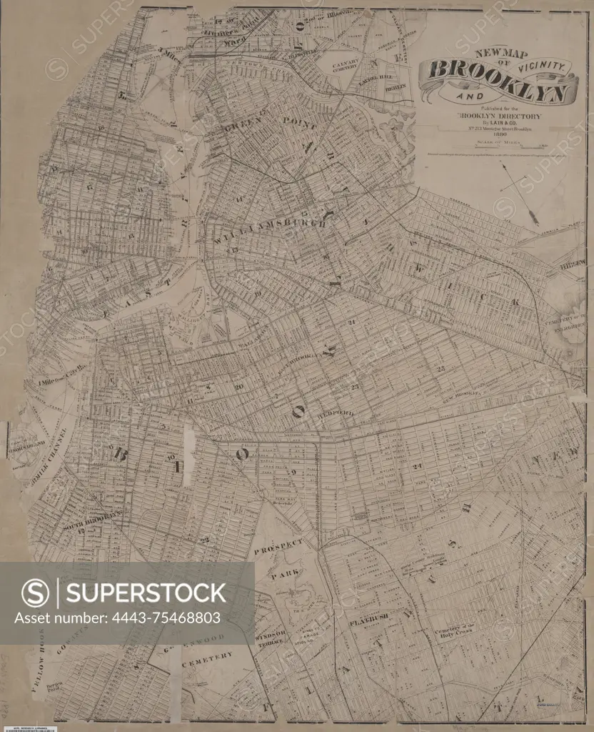
New Map of Brooklyn and vicinity, for the Brooklyn City Directory, issued in 1880 by Lain & Co., Brooklyn (New York, N.Y.). The map measures 56 x 69 cm
SuperStock offers millions of photos, videos, and stock assets to creatives around the world. This image of New Map of Brooklyn and vicinity, for the Brooklyn City Directory, issued in 1880 by Lain & Co., Brooklyn (New York, N.Y.). The map measures 56 x 69 cm by Artokoloro is available for licensing today.
Looking for a license?
Click here, and we'll help you find it! Questions? Just ask!
Click here, and we'll help you find it! Questions? Just ask!
DETAILS
Image Number: 4443-75468803Rights ManagedCredit Line:Artokoloro/SuperStockCollection:Artokoloro Model Release:NoProperty Release:NoResolution:4635×5700