A new general chart for the West Indies based on E. Wright's projection, published by T. Bennet in London in 1705. The chart is a nautical representation of the West Indies and the Atlantic Ocean. It measures 46 x 57 cm when unfolded and is folded to 37 x 20 cm
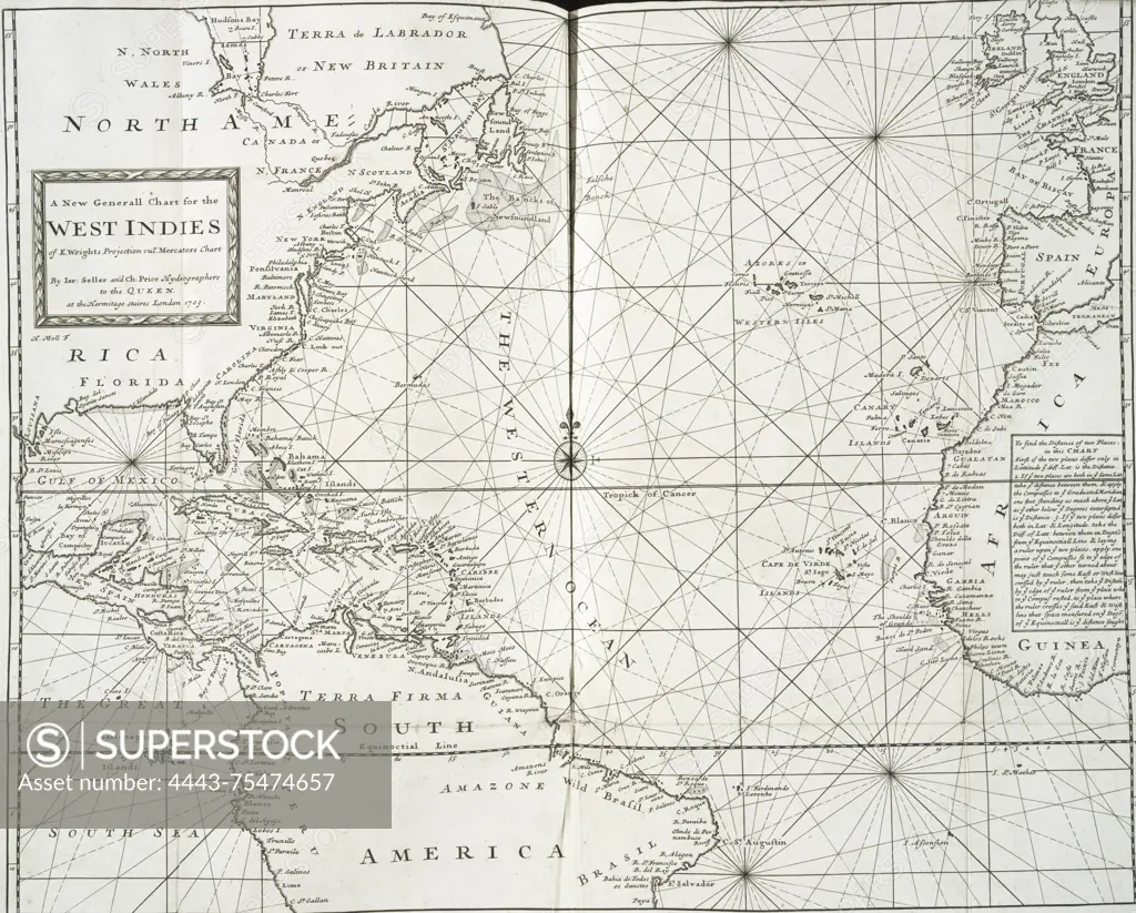
SuperStock offers millions of photos, videos, and stock assets to creatives around the world. This image of A new general chart for the West Indies based on E. Wright's projection, published by T. Bennet in London in 1705. The chart is a nautical representation of the West Indies and the Atlantic Ocean. It measures 46 x 57 cm when unfolded and is folded to 37 x 20 cm by Artokoloro is available for licensing today.
Looking for a license?
Click here, and we'll help you find it! Questions? Just ask!
Click here, and we'll help you find it! Questions? Just ask!
DETAILS
Image Number: 4443-75474657Rights ManagedCredit Line:Artokoloro/SuperStockCollection:Artokoloro Model Release:NoProperty Release:NoResolution:5110×4107