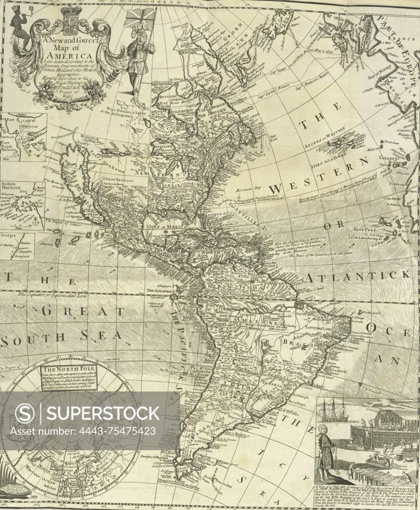
A new and correct map of America laid down according to the accurate improvements of Senex, Moll, and other modern geographers., 1738., London. Publisher, Printed at the expense of the Society for the Encouragement of Learning, by S. Richardson. Details include West Indies, British, Virginia, History, Colonial period, ca. 1600-1775, Cod fisheries, Newfoundland and Labrador, North America Maps -- Early works to 1800., 1 map; 54 x 46 cm, folded to 23 x 16 cm
SuperStock offers millions of photos, videos, and stock assets to creatives around the world. This image of A new and correct map of America laid down according to the accurate improvements of Senex, Moll, and other modern geographers., 1738., London. Publisher, Printed at the expense of the Society for the Encouragement of Learning, by S. Richardson. Details include West Indies, British, Virginia, History, Colonial period, ca. 1600-1775, Cod fisheries, Newfoundland and Labrador, North America Maps -- Early works to 1800., 1 map; 54 x 46 cm, folded to 23 x 16 cm by Artokoloro is available for licensing today.
Looking for a license?
Click here, and we'll help you find it! Questions? Just ask!
Click here, and we'll help you find it! Questions? Just ask!
DETAILS
Image Number: 4443-75475423Rights ManagedCredit Line:Artokoloro/SuperStockCollection:Artokoloro Model Release:NoProperty Release:NoResolution:3143×3813