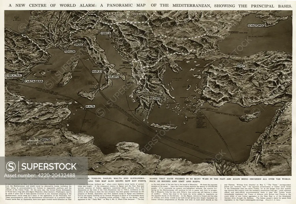
A new centre of world alarm during the Second World War: a panoramic map of the Mediterranean, showing the principal bases. The framework of strategy in the Mediterranean: Gibraltar, Toulon, Naples, Malta and Alexandria -- names that have figured in so many wars in the past -- are again being discussed all over the world. This map also shows new key points, such as Rhodes, Izmit and Haifa. Date: 1940
SuperStock offers millions of photos, videos, and stock assets to creatives around the world. This image of Explore the Historic Mediterranean: Detailed Panoramic Map Highlighting Key Bases and Regions for Strategic Insight. by Illustrated London News Ltd/Mary Evans Picture Library/Pantheon is available for licensing today.
Looking for a license?
Click here, and we'll help you find it! Questions? Just ask!
Click here, and we'll help you find it! Questions? Just ask!
DETAILS
Image Number: 4220-20432488Rights ManagedCredit Line:Illustrated London News Ltd/Mary Evans Picture Library/Pantheon/SuperStockCollection:Mary Evans Picture Library Contributor:Illustrated London News Ltd Model Release:NoProperty Release:NoResolution:6518×4516