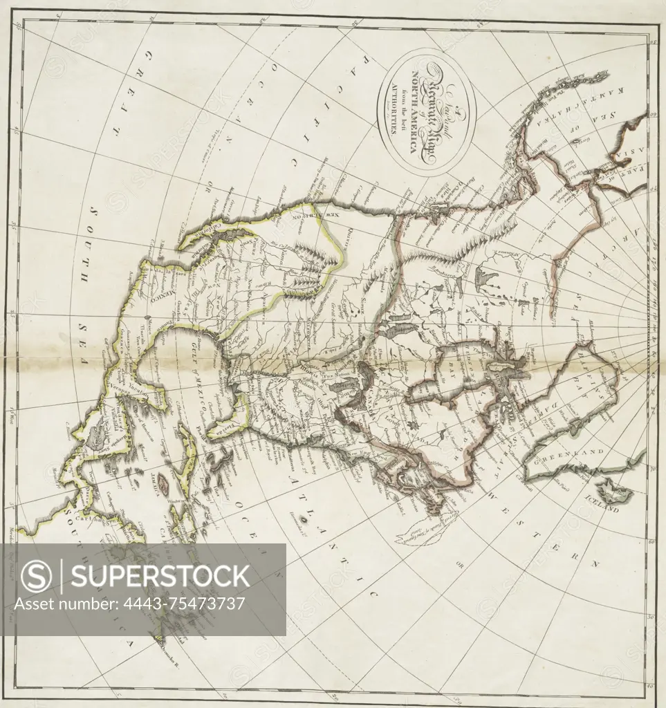
A new and accurate map of North America from the best authorities, published in 1814 by M. Carey in Philadelphia. The map is hand-colored and measures 34 x 36 cm
SuperStock offers millions of photos, videos, and stock assets to creatives around the world. This image of A new and accurate map of North America from the best authorities, published in 1814 by M. Carey in Philadelphia. The map is hand-colored and measures 34 x 36 cm by Artokoloro is available for licensing today.
Looking for a license?
Click here, and we'll help you find it! Questions? Just ask!
Click here, and we'll help you find it! Questions? Just ask!
DETAILS
Image Number: 4443-75473737Rights ManagedCredit Line:Artokoloro/SuperStockCollection:Artokoloro Model Release:NoProperty Release:NoResolution:3042×3232