A new and accurate map of North America, dated 1763, created by John Hinton. The map is hand-colored and measures 27 x 35 cm. It was published in London by J. Hinton, Newgate Street, and is based on the latest observations and discoveries of the time
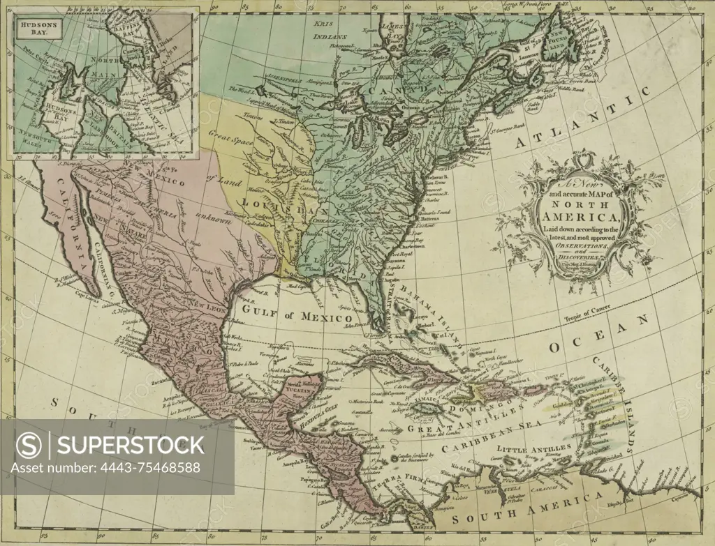
SuperStock offers millions of photos, videos, and stock assets to creatives around the world. This image of A new and accurate map of North America, dated 1763, created by John Hinton. The map is hand-colored and measures 27 x 35 cm. It was published in London by J. Hinton, Newgate Street, and is based on the latest observations and discoveries of the time by Artokoloro is available for licensing today.
Looking for a license?
Click here, and we'll help you find it! Questions? Just ask!
Click here, and we'll help you find it! Questions? Just ask!
DETAILS
Image Number: 4443-75468588Rights ManagedCredit Line:Artokoloro/SuperStockCollection:Artokoloro Model Release:NoProperty Release:NoResolution:3982×3048