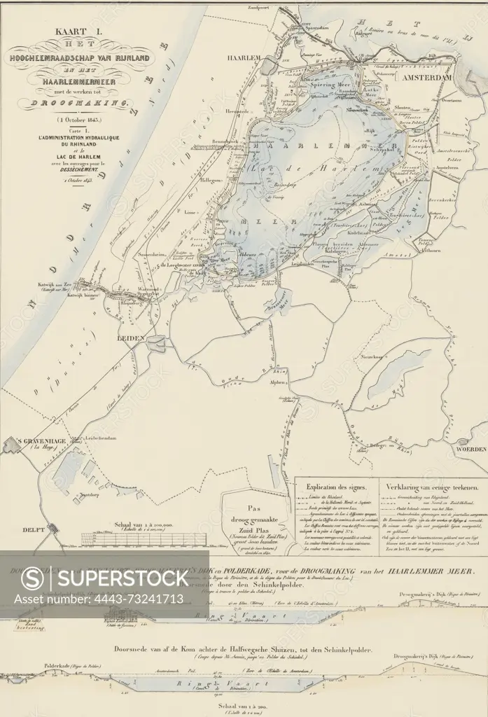
Netherlands, Suite of ten maps and plates of the drainage of the Haarlemmermeer 1843-1860, Map I. The Hoogheemraadschap van Rijnland en het Haarlemmermeer with the works for drainage (1 October 1843.), verso - stamped, Map of the Hoogheemraadschap van Rijnland en het Haarlemmermeer, with the plans for the drainage on 1 October 1843. At the bottom two cross-sections of the Ringvaart, ring dike and polder dike. Inscriptions in Dutch and French. Part of a suite of ten plates of the drainage of the Haarlemmermeer, 1843-1860., print, prent, map, prints, Frederik Muller Historieplaten, height 755 mm, width 562 mm, print maker, prentmaker, 1843 - 1861, paper, papier, lithografie (technique), hand-coloured" Netherlands
SuperStock offers millions of photos, videos, and stock assets to creatives around the world. This image of Netherlands, Suite of ten maps and plates of the drainage of the Haarlemmermeer 1843-1860, Map I. The Hoogheemraadschap van Rijnland en het Haarlemmermeer with the works for drainage (1 October 1843.), verso - stamped, Map of the Hoogheemraadschap van Rijnland en het Haarlemmermeer, with the plans for the drainage on 1 October 1843. At the bottom two cross-sections of the Ringvaart, ring dike and polder dike. Inscriptions in Dutch and French. Part of a suite of ten plates of the drainage of the Haarlemmermeer, 1843-1860., print, prent, map, prints, Frederik Muller Historieplaten, height 755 mm, width 562 mm, print maker, prentmaker, 1843 - 1861, paper, papier, lithografie (technique), hand-coloured" Netherlands by Artokoloro is available for licensing today.
Looking for a license?
Click here, and we'll help you find it! Questions? Just ask!
Click here, and we'll help you find it! Questions? Just ask!
DETAILS
Image Number: 4443-73241713Rights ManagedCredit Line:Artokoloro/SuperStockCollection:Artokoloro Model Release:NoProperty Release:NoResolution:3679×5400