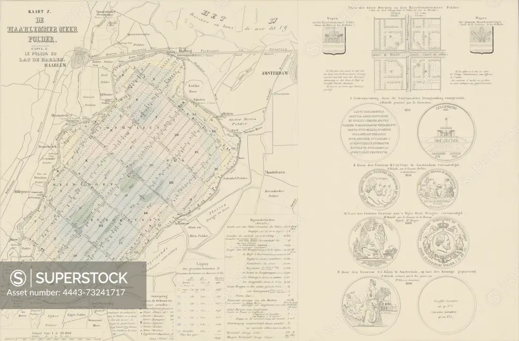
Netherlands, Royal Dutch Lithographic Printing House of C.W. Mieling, Suite of ten maps and plates of the drainage of the Haarlemmermeer 1843-1860, Map X. The Haarlemmer Meer Polder, Map of the parcelization of the Haarlemmermeerpolder. On the right a plan of two new villages planned in the polder. Below that are four medals (from 1855, 1858, and two from 1860) celebrating the reclamation. Inscriptions in Dutch and French. Part of a suite of ten plates of the reclamation of the Haarlemmermeer, 1843-1860., print, picture, map, prints, Frederik Muller Historieplaten, height 545 mm, width 730 mm, print maker, printmaker, 1860 - 1861, paper, papier, lithografie (technique), handkleuring, printer, drukker
SuperStock offers millions of photos, videos, and stock assets to creatives around the world. This image of Netherlands, Royal Dutch Lithographic Printing House of C.W. Mieling, Suite of ten maps and plates of the drainage of the Haarlemmermeer 1843-1860, Map X. The Haarlemmer Meer Polder, Map of the parcelization of the Haarlemmermeerpolder. On the right a plan of two new villages planned in the polder. Below that are four medals (from 1855, 1858, and two from 1860) celebrating the reclamation. Inscriptions in Dutch and French. Part of a suite of ten plates of the reclamation of the Haarlemmermeer, 1843-1860., print, picture, map, prints, Frederik Muller Historieplaten, height 545 mm, width 730 mm, print maker, printmaker, 1860 - 1861, paper, papier, lithografie (technique), handkleuring, printer, drukker by Artokoloro is available for licensing today.
Looking for a license?
Click here, and we'll help you find it! Questions? Just ask!
Click here, and we'll help you find it! Questions? Just ask!
DETAILS
Image Number: 4443-73241717Rights ManagedCredit Line:Artokoloro/SuperStockCollection:Artokoloro Model Release:NoProperty Release:NoResolution:5400×3554